
Image: Vertreibungsgebiet
Size of this preview: 797 × 600 pixels. Other resolutions: 319 × 240 pixels | 1,094 × 823 pixels.
Original image (1,094 × 823 pixels, file size: 383 KB, MIME type: image/jpeg)
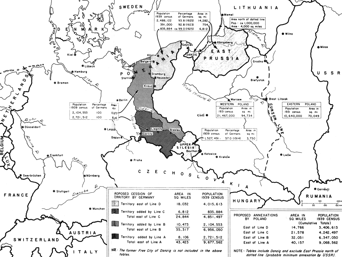
Description: Allied map used to determine the number of Germans that would have to be expelled from the eastern German territories using different border scenarios
Title: Vertreibungsgebiet
Credit: http://digicoll.library.wisc.edu/cgi-bin/FRUS/FRUS-idx?type=turn&entity=FRUS.FRUS1945Berlinv01.p0881&isize=M http://www.deutschlanddokumente.de/
Author: amerikanisches Außenministerium
Usage Terms: Creative Commons Attribution-Share Alike 3.0
License: CC-BY-SA-3.0
License Link: http://creativecommons.org/licenses/by-sa/3.0/
Attribution Required?: Yes
Image usage
The following 3 pages link to this image:

All content from Kiddle encyclopedia articles (including the article images and facts) can be freely used under Attribution-ShareAlike license, unless stated otherwise.