
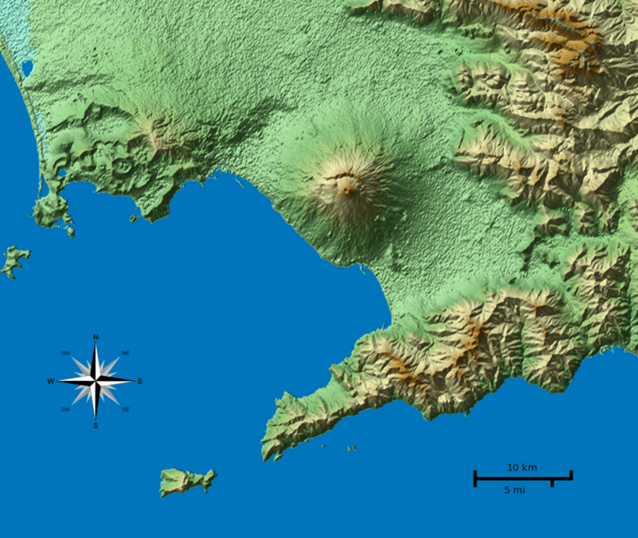
Image: Vesuvius SRTM3

Description: Shaded terrain map of the Naples and Mount Vesuvius region from SRTM3 elevation data. Each pixel corresponds to about 70x70 m. SRTM tile used was http://dds.cr.usgs.gov/srtm/version2_1/SRTM3/Eurasia/N40E014.hgt.zip. The top of the image is 41°N, the left side is 14°E. Note: This image has annotations, but you have to navigate to the Wikimedia Commons description page to see them. Or (if you are logged in at Wikipedia) go to "My preferences -> Gadgets" and enable ImageAnnotator.
Title: Vesuvius SRTM3
Credit: Own work
Author: Morn the Gorn compass rose from Maps_template-fr.svg: Eric Gaba (Sting - fr:Sting)
Usage Terms: Creative Commons Attribution-Share Alike 3.0
License: CC BY-SA 3.0
License Link: http://creativecommons.org/licenses/by-sa/3.0
Attribution Required?: Yes
Image usage
The following page links to this image:
