
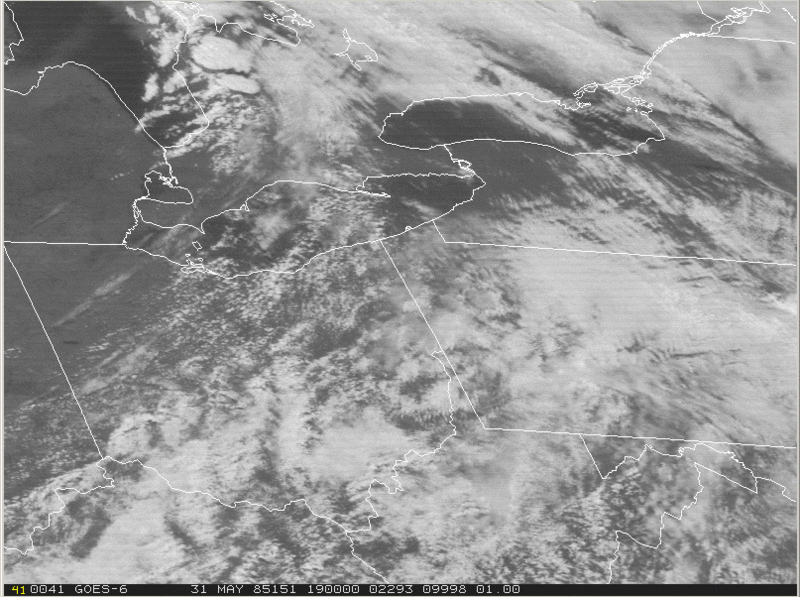
Image: Visible satellite loop May 31 1985

Size of this preview: 800 × 597 pixels. Other resolutions: 320 × 239 pixels | 807 × 602 pixels.
Original image (807 × 602 pixels, file size: 8.23 MB, MIME type: image/gif, looped, 36 frames, 3.6 s)
Note: Due to technical limitations, thumbnails of high resolution GIF images such as this one will not be animated.
Description: Visible satellite image lopp from GOES 6 showing storms which produced a violent tornado outbreak. From National Weather Service website: The Tornado Outbreak of May 31, 1985 (file link)
Title: Visible satellite loop May 31 1985
Credit: http://www.erh.noaa.gov/er/cle/office/localinterest/1985Tornado/VIS_SAT_1985_MAY_31.gif
Author: National Oceanic and Atmospheric Administration
Permission: Public Domain
Usage Terms: Public domain
License: Public domain
Attribution Required?: No
Image usage
The following page links to this image:

All content from Kiddle encyclopedia articles (including the article images and facts) can be freely used under Attribution-ShareAlike license, unless stated otherwise.