
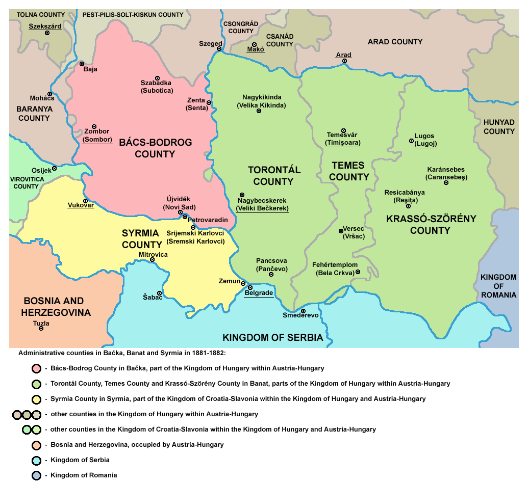
Image: Vojvodina10
Size of this preview: 655 × 600 pixels. Other resolutions: 262 × 240 pixels | 1,035 × 948 pixels.
Original image (1,035 × 948 pixels, file size: 133 KB, MIME type: image/png)
Description: Historic map of counties in Bačka, Banat and Syrmia in 1881-1882.
Title: Vojvodina10
Credit: Transferred from en.wikipedia to Commons by Avemundi.
Author: Original uploader and author was PANONIAN at en.wikipedia
Usage Terms: Public domain
License: Public domain
Attribution Required?: No
Image usage

All content from Kiddle encyclopedia articles (including the article images and facts) can be freely used under Attribution-ShareAlike license, unless stated otherwise.