
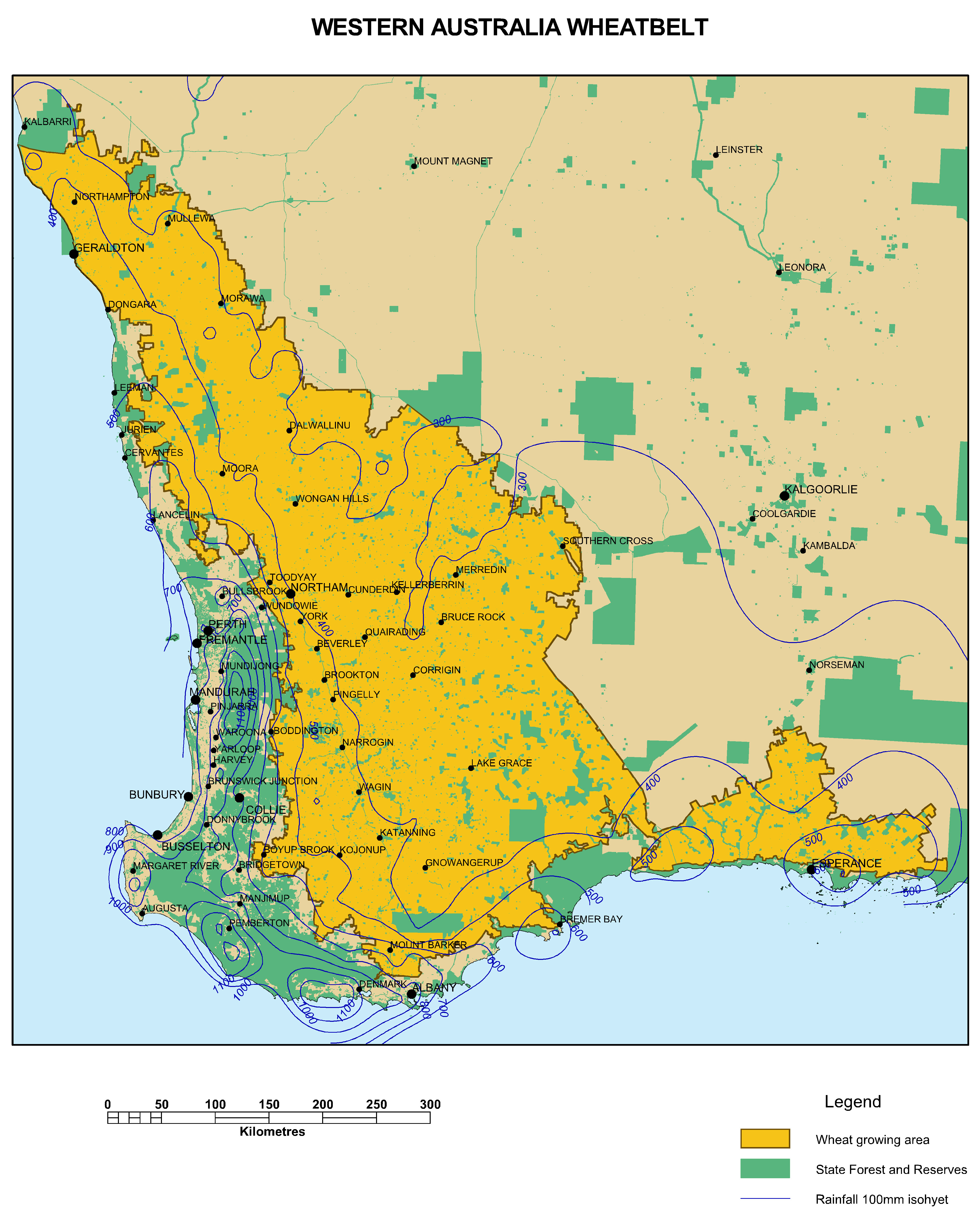
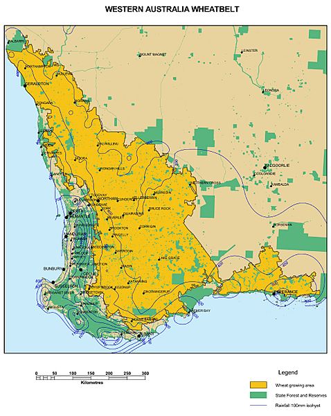
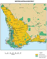
Image: WA Wheatbelt A4
Size of this preview: 478 × 600 pixels. Other resolutions: 191 × 240 pixels | 4,055 × 5,086 pixels.
Original image (4,055 × 5,086 pixels, file size: 3.89 MB, MIME type: image/jpeg)
Description: DAFWA Reference Library Map - Wheatbelt of Western Australia
Title: WA Wheatbelt A4
Credit: https://catalogue.data.wa.gov.au/dataset/wheatbelt-of-wa-dafwa-031/resource/a8e4e13d-9cb4-45f5-a853-46538f52b4f2
Author: Western Australian Government - Department of Agriculture and Food
Usage Terms: Creative Commons Attribution 4.0
License: CC BY 4.0
License Link: https://creativecommons.org/licenses/by/4.0
Attribution Required?: Yes
Image usage
The following page links to this image:

All content from Kiddle encyclopedia articles (including the article images and facts) can be freely used under Attribution-ShareAlike license, unless stated otherwise.