
Image: WWI-Marne-map-Charly

Size of this preview: 464 × 599 pixels. Other resolutions: 186 × 240 pixels | 826 × 1,066 pixels.
Original image (826 × 1,066 pixels, file size: 167 KB, MIME type: image/jpeg)
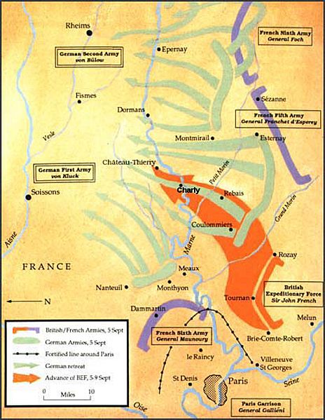
Description: Map of the First battle of the Marne showing the British Expeditionary Force counter-attack and the town of Charly
Title: WWI-Marne-map-Charly
Credit: modified from official British report (1914)
Author: Thaddeus P. Bejnar and British government
Permission: GFDL
Usage Terms: Creative Commons Attribution-Share Alike 3.0
License: CC-BY-SA-3.0
License Link: http://creativecommons.org/licenses/by-sa/3.0/
Attribution Required?: Yes
Image usage
The following page links to this image:

All content from Kiddle encyclopedia articles (including the article images and facts) can be freely used under Attribution-ShareAlike license, unless stated otherwise.