
Image: Wales 14C Map
Size of this preview: 564 × 599 pixels. Other resolutions: 226 × 240 pixels | 3,399 × 3,610 pixels.
Original image (3,399 × 3,610 pixels, file size: 1.82 MB, MIME type: image/png)
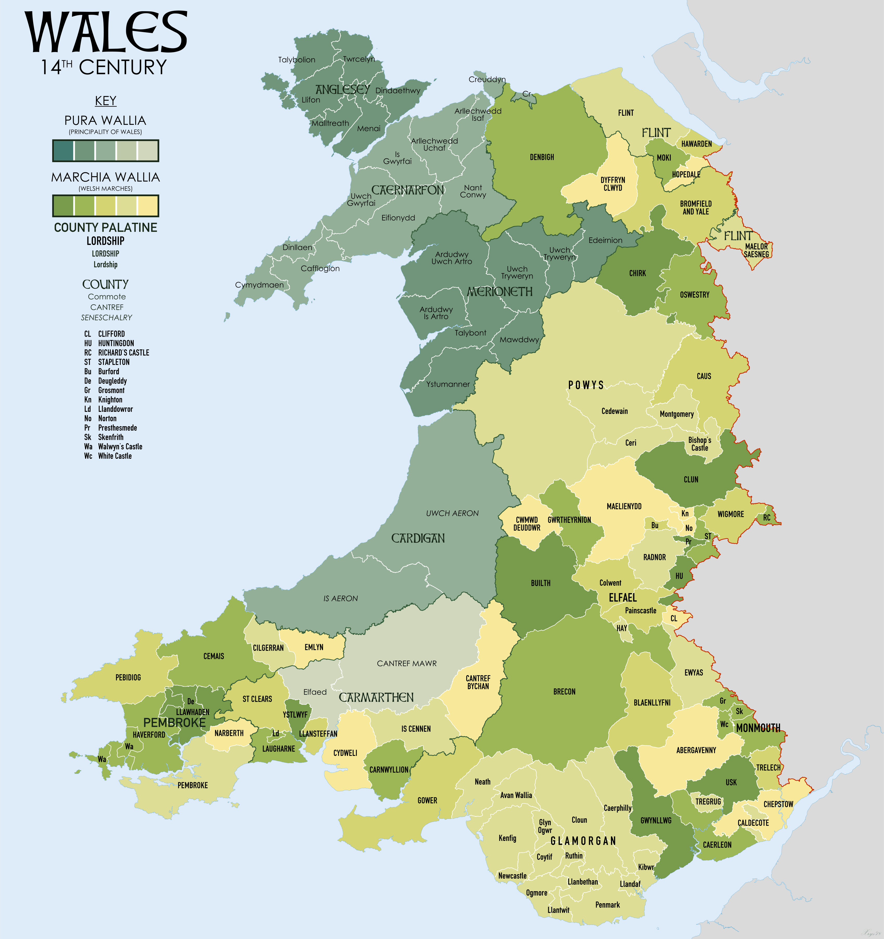
Description: Map of Wales in the 14th Century showing The Principality and Welsh Marches. Source data: South Wales and the Border in the Fourteenth Century (1933) W.M.Rees. Max Lieberman, The March of Wales (1067-1300) (from https://mappingwelshmarches.ac.uk/). RCAHMW Mapping the Medieval Cantrefi and Commotes of Wales (https://rcahmw.gov.uk/mapping-the-historic-boundaries-of-wales-commotes-and-cantrefs/)Kain, R.J.P., and Oliver, R.R. (2001) "Historic parishes of England and Wales".
Title: Wales 14C Map
Credit: Own work
Author: XrysD
Usage Terms: Creative Commons Attribution-Share Alike 4.0
License: CC BY-SA 4.0
License Link: https://creativecommons.org/licenses/by-sa/4.0
Attribution
Image usage
The following 2 pages link to this image:

All content from Kiddle encyclopedia articles (including the article images and facts) can be freely used under Attribution-ShareAlike license, unless stated otherwise.