
Image: Washington Navy Yard aerial view 1960
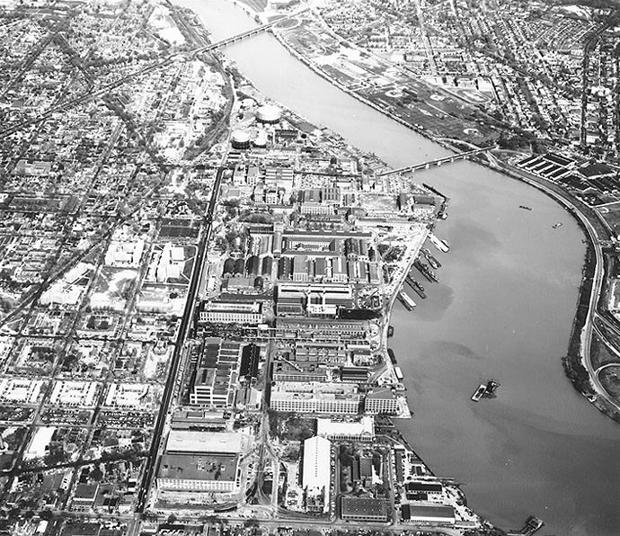
Description: Aerial view of the Washington Navy Yard and its Navy Yard district vicinity — looking eastward from over the South Capitol Street area, circa 1960. The Yard's western edge, at First Street SE, is near the lower edge of the photo; its northern boundary, at M Street SE, is marked by the dark-colored street running nearly vertically in the left center. The Anacostia River runs diagonally from lower left to upper right center, crossed by the Eleventh Street Bridge (in center) and the John Philip Sousa Bridge (Pennsylvania Avenue) (near the top).
Title: Washington Navy Yard aerial view 1960
Credit: Naval Historical Center
Author: U.S. Navy
Usage Terms: Public domain
License: Public domain
Attribution Required?: No
Image usage
The following page links to this image:
