
Image: Weddell-Island-Satellite-Image
Size of this preview: 690 × 599 pixels. Other resolutions: 276 × 240 pixels | 907 × 788 pixels.
Original image (907 × 788 pixels, file size: 456 KB, MIME type: image/jpeg)
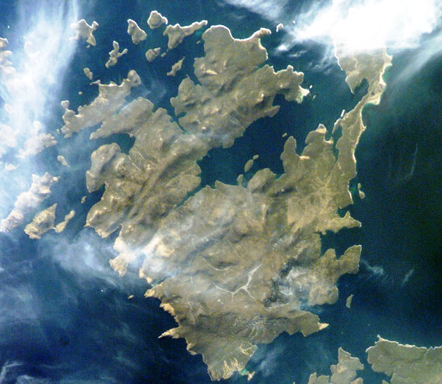
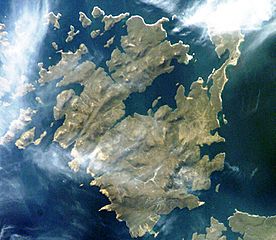
Description: Satellite image of Weddell Island, Falkland Islands
Title: Weddell-Island-Satellite-Image
Credit: https://web.archive.org/web/20101223044948/http://oceandots.com/atlantic/falklands/weddell.php
Author: This image or video was catalogued by one of the centers of the United States National Aeronautics and Space Administration (NASA) under Photo ID: ISS011-E-5251.
Usage Terms: Public domain
License: Public domain
Attribution Required?: No
Image usage
The following 17 pages link to this image:
- Chatham Harbour, Weddell Island
- Circum Peak
- Governor Island, Falkland Islands
- Gull Harbour
- Horse Block
- Hotham Heights
- Loop Head, Weddell Island
- Mount Weddell
- Pillar Bluff
- Pitt Heights
- Quaker Harbour
- Race Point
- Smylie Channel
- Swan Point, Weddell Island
- Weddell Island
- Weddell Point, Weddell Island
- Weddell Settlement

All content from Kiddle encyclopedia articles (including the article images and facts) can be freely used under Attribution-ShareAlike license, unless stated otherwise.