
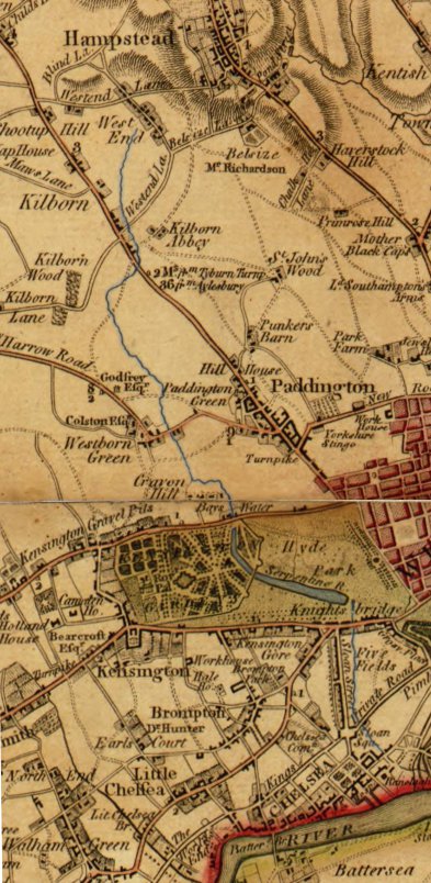
Image: Westbourne-route-1790
Size of this preview: 293 × 599 pixels. Other resolutions: 117 × 240 pixels | 393 × 804 pixels.
Original image (393 × 804 pixels, file size: 108 KB, MIME type: image/jpeg)
Description: Route of the River Westbourne (highlighted in blue) shown between West End (now known as West Hampstead) and the Thames on a 1790 map.
Title: Westbourne-route-1790
Credit: Crop of US Library of Congress scan of 1790 map by Faden, William http://hdl.loc.gov/loc.gmd/g5754l.ct002421
Author: Faden, William
Usage Terms: Public domain
License: Public domain
Attribution Required?: No
Image usage
The following 2 pages link to this image:

All content from Kiddle encyclopedia articles (including the article images and facts) can be freely used under Attribution-ShareAlike license, unless stated otherwise.