
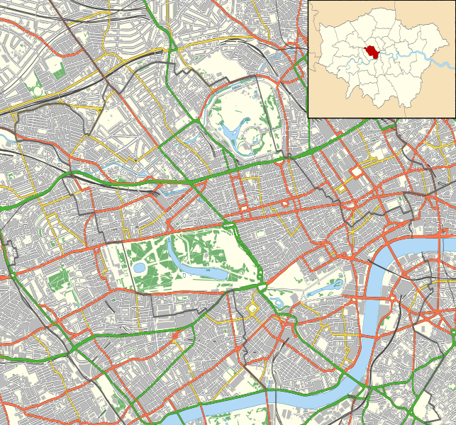
Image: Westminster London UK location map

Description: Location map of the City of Westminster with the following information shown: Ward boundaries Motorways Primary routes Non-primary A roads B roads Minor roads Railways Water Woodland Buildings Equirectangular map projection on WGS 84 datum, with N/S stretched 160% Geographic limits: West: 0.22W East: 0.10W North: 51.55N South: 51.48N
Title: Westminster London UK location map
Credit: Ordnance Survey OpenData. Ward data from Boundary-Line product. All other data from VectorMap District product.
Author: Nilfanion
Permission: This file is licensed under the Creative Commons Attribution-Share Alike 3.0 Unported license. Attribution: Contains Ordnance Survey data © Crown copyright and database right You are free: to share – to copy, distribute and transmit the work to remix – to adapt the work Under the following conditions: attribution – You must give appropriate credit, provide a link to the license, and indicate if changes were made. You may do so in any reasonable manner, but not in any way that suggests the licensor endorses you or your use. share alike – If you remix, transform, or build upon the material, you must distribute your contributions under the same or compatible license as the original. https://creativecommons.org/licenses/by-sa/3.0 CC BY-SA 3.0 Creative Commons Attribution-Share Alike 3.0 truetrue
Usage Terms: Creative Commons Attribution-Share Alike 3.0
License: CC BY-SA 3.0
License Link: https://creativecommons.org/licenses/by-sa/3.0
Attribution Required?: Yes
Image usage
The following 16 pages link to this image:
- Church of the Annunciation, Marble Arch
- Downing Street
- Fitzrovia Chapel
- Millbank Millennium Pier
- Oxford Street
- Pall Mall, London
- Park Lane
- Queen Alexandra Military Hospital
- Queen Anne's Gate
- Royal Army Medical College
- St Cyprian's, Clarence Gate
- St Etheldreda's Church
- St Mary's, Bryanston Square
- Strand, London
- Trafalgar Square
- UK Holocaust Memorial
