
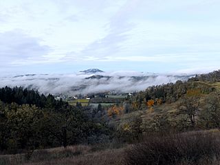
Image: Willamette Valley fog

Size of this preview: 800 × 600 pixels. Other resolutions: 320 × 240 pixels | 4,000 × 3,000 pixels.
Original image (4,000 × 3,000 pixels, file size: 2.73 MB, MIME type: image/jpeg)
Description: Fog and low clouds hovering over Eugene and other parts of the southern Willamette Valley, as seen from Mount Pisgah in Lane County, Oregon. Spencer Butte is the highest hill in the distance.
Title: Willamette Valley fog
Credit: Own work
Author: Jsayre64
Usage Terms: Public domain
License: Public domain
Attribution Required?: No
Image usage
The following page links to this image:

All content from Kiddle encyclopedia articles (including the article images and facts) can be freely used under Attribution-ShareAlike license, unless stated otherwise.