
Image: Willem Blaeu00
Size of this preview: 786 × 600 pixels. Other resolutions: 315 × 240 pixels | 1,140 × 870 pixels.
Original image (1,140 × 870 pixels, file size: 399 KB, MIME type: image/jpeg)
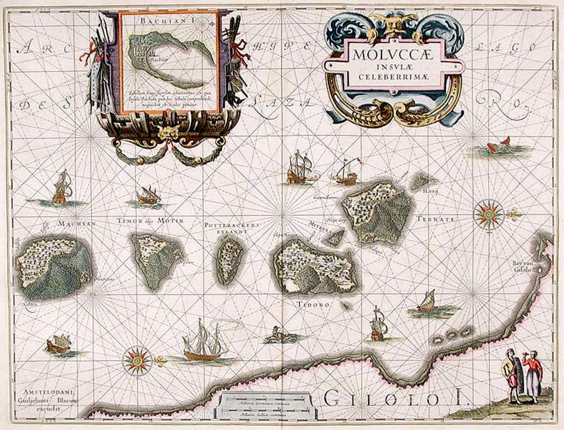
Description: "Moluccæ Insulæ Celeberrimæ". Blaeu's map, which first appeared in 1630 in the Atlantis Appendix., was the first large-scale, detailed map of the now Dutch-controlled islands. It shows the heavily forested nature of the islands and the recently constructed forts. North is on the right direction, with Ternate in the rightmost island followed by Tidore, Mare, Moti and Makian islands. The bottom is the Gilolo (Jailolo or Halmahera) Island. Inset on the top is Bacan Island.
Title: Willem Blaeu00
Credit: http://www.donaldheald.com/s12772.html
Author: Willem Janszoon Blaeu (1571-1638)
Permission: Public domain
Usage Terms: Public domain
License: Public domain
Attribution Required?: No
Image usage
The following 3 pages link to this image:

All content from Kiddle encyclopedia articles (including the article images and facts) can be freely used under Attribution-ShareAlike license, unless stated otherwise.