
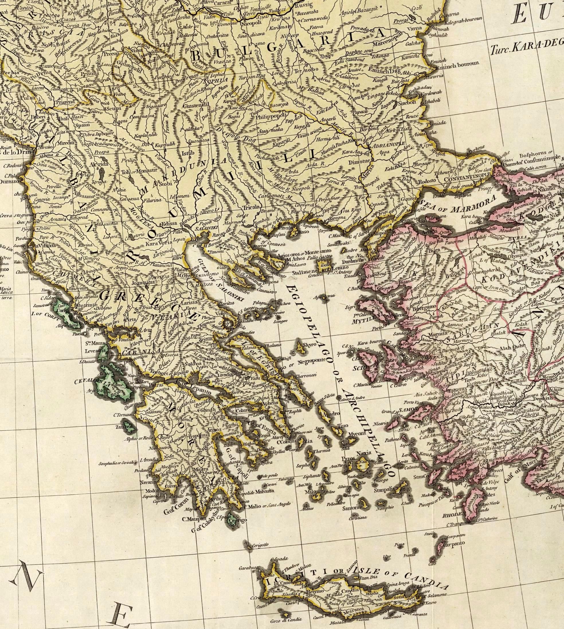
Image: William Faden. Composite Mediterranean. 1785.I
Size of this preview: 537 × 599 pixels. Other resolutions: 215 × 240 pixels | 1,968 × 2,195 pixels.
Original image (1,968 × 2,195 pixels, file size: 1.2 MB, MIME type: image/jpeg)
Description: (Composite of) A map of the Mediterranean Sea with the adjacent regions and seas in Europe, Asia and Africa. By William Faden, Geographer to the King. London, printed for Wm. Faden, Charing Cross, March 1st, 1785.
Usage Terms: Public domain
Image usage
The following page links to this image:

All content from Kiddle encyclopedia articles (including the article images and facts) can be freely used under Attribution-ShareAlike license, unless stated otherwise.