
Image: Wiltshire UK location map

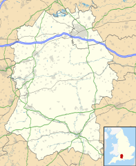
Description: Map of Wiltshire, UK with the following information shown: Administrative borders Coastline, lakes and rivers Roads and railways Urban areas Equirectangular map projection on WGS 84 datum, with N/S stretched 160% Geographic limits: West: 2.40W East: 1.35W North: 51.72N South: 50.92N
Title: Wiltshire UK location map
Credit: Ordnance Survey OpenData. Administrative borders and coastline data from Boundary-Line product. All other geographic data from Meridian 2 product. Inset derived from England location map.svg by Spischot.
Author: Nilfanion, created using Ordnance Survey data
Permission: This file is licensed under the Creative Commons Attribution-Share Alike 3.0 Unported license. Attribution: Contains Ordnance Survey data © Crown copyright and database right You are free: to share – to copy, distribute and transmit the work to remix – to adapt the work Under the following conditions: attribution – You must attribute the work in the manner specified by the author or licensor (but not in any way that suggests that they endorse you or your use of the work). share alike – If you alter, transform, or build upon this work, you may distribute the resulting work only under the same or similar license to this one. http://creativecommons.org/licenses/by-sa/3.0 CC BY-SA 3.0 Creative Commons Attribution-Share Alike 3.0 truetrue
Usage Terms: Creative Commons Attribution-Share Alike 3.0
License: CC BY-SA 3.0
License Link: http://creativecommons.org/licenses/by-sa/3.0
Attribution Required?: Yes
Image usage
The following 98 pages link to this image:
- Alderbury
- Allington, Salisbury
- Amesbury
- Amesbury Priory
- Aston Valley Barrow Cemetery
- Avebury (village)
- Barbury Castle
- Battlesbury Camp
- Bincknoll Castle
- Bishopstone, Salisbury
- Bradford-on-Avon
- Bratton Castle
- Bury Camp
- Bush Barrow
- Calne
- Casterley Camp
- Castle Ditches
- Castle Hill, Mere
- Chapel Plaister
- Chilmark, Wiltshire
- Chippenham
- Chisbury
- Chiselbury
- Chisenbury Camp
- Christ Church, Broad Town
- Christ Church, Warminster
- Corsham
- Cricklade
- Day House Lane Stone Circle
- Devizes
- Devizes Castle
- Ebsbury
- Falkner's Circle
- Fir Clump Stone Circle
- Fosbury Camp
- Fyfield Down
- Garrison Church of St Alban the Martyr, Larkhill
- Grovely Castle
- Heytesbury
- Highworth
- Imber
- Kington St Michael
- Lacock
- Laverstock
- Liddington Castle
- Longleat Priory
- Ludgershall, Wiltshire
- Ludgershall Castle
- Malmesbury
- Malmesbury Abbey
- Malmesbury Castle
- Marden Henge
- Marlborough, Wiltshire
- Marlborough Castle
- Marlborough Mound
- Marlborough White Horse
- Melksham
- Membury Camp
- Mere, Wiltshire
- Morgan's Hill Enclosure
- Netheravon Airfield
- Nettleton, Wiltshire
- Nile Clumps
- Normanton Down Barrows
- Old Sarum Airfield
- Old Sarum Castle
- RAF Blakehill Farm
- RAF Rudloe Manor
- RAF Upavon
- RAF Zeals
- Ringsbury Camp
- Royal Wootton Bassett
- Salisbury
- Scratchbury Camp
- Shalbourne
- Sidbury Hill
- Snap, Wiltshire
- St Aldhelm's Roman Catholic Church, Malmesbury
- St Andrew's Church, Chippenham
- St Mary's Church, Calne
- St Mary's Church, Marlborough
- St Michael's Church, Melksham
- St Sampson's Church, Cricklade
- Steeple Ashton
- Swindon
- Tidworth
- Tisbury, Wiltshire
- Trowbridge
- Upper Upham
- Vincients Wood
- Warminster
- West Ashton
- West Kennet Long Barrow
- Westbury, Wiltshire
- Wilsford Henge
- Wilton, Wiltshire
- Yarnbury Castle
- Template:Location map United Kingdom Wiltshire
