
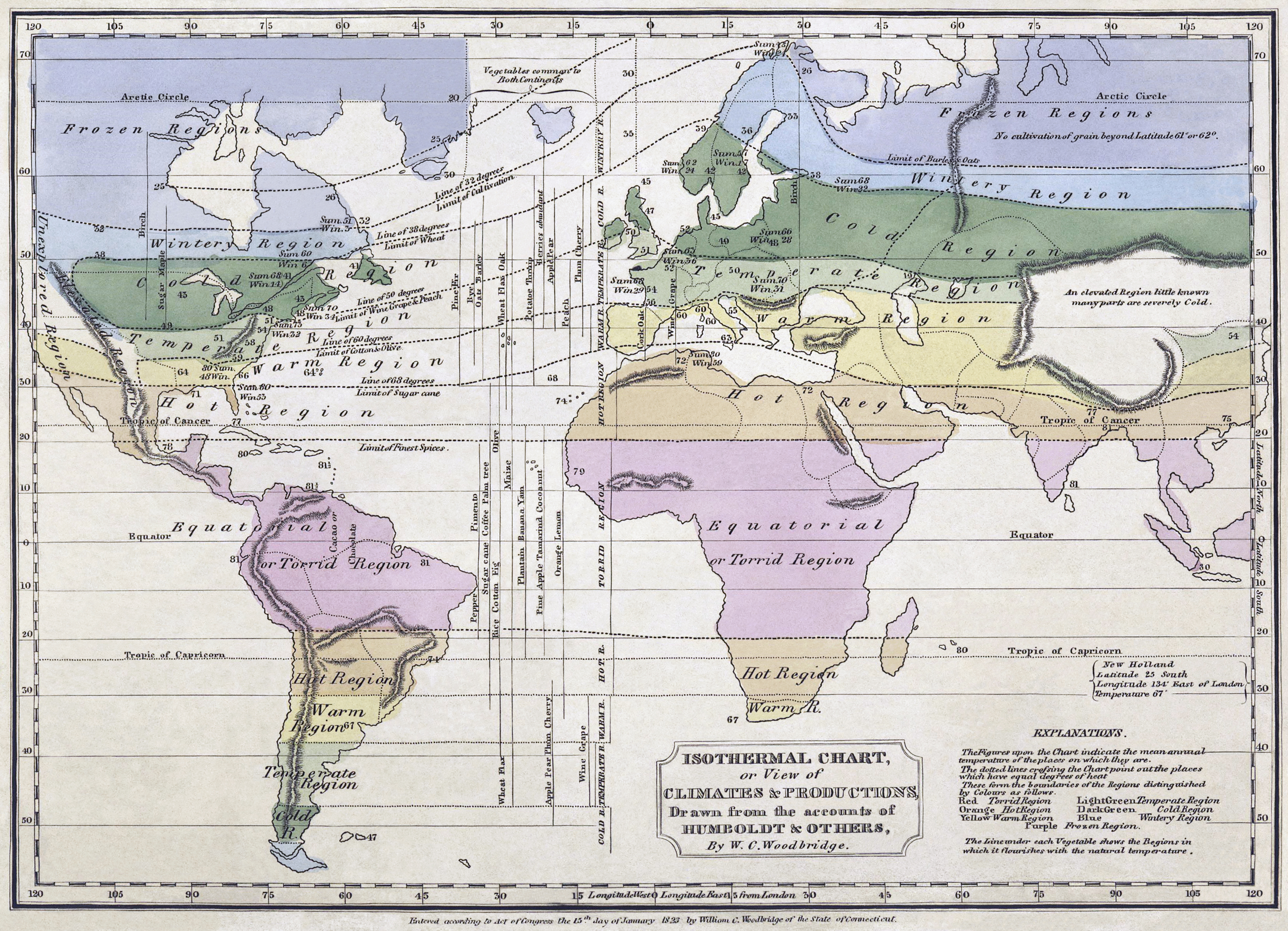
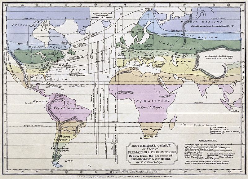
Image: Woodbridge isothermal chart3
Description: Isothermal chart, or, View of climates & productions / drawn from the accounts of Humboldt & others, by W.C. Woodbridge. Notes: Relief shown by hachures. Note 2.) "Entered according to Act of Congress the 15th day of January, 1823, by William C. Woodbridge of the state of Connecticut." Note 3.) Covers most of the world; does not cover northwestern North America, northeastern Asia, Australia, polar regions, or most of the Pacific Ocean. Note 4.) Includes notes. Note 5.) National Endowment for the Humanities Grant for Access to Early Maps of the Middle Atlantic Seaboard. Note 6.) Prime meridian: London.
Title: Woodbridge isothermal chart3
Credit: This image is available from the New York Public Library's Digital Library under the digital ID 465012: digitalgallery.nypl.org → digitalcollections.nypl.org This tag does not indicate the copyright status of the attached work. A normal copyright tag is still required. See Commons:Licensing for more information. беларуская (тарашкевіца) | বাংলা | English | français | Nederlands | русский | Türkçe | 中文 |+/−
Author: William Channing Woodbridge (Cartographer), Alexander von Humboldt (Author). Restoration by Jujutacular and Durova.
Usage Terms: Public domain
License: Public domain
Attribution Required?: No
Image usage
The following page links to this image:
