
Image: Woolwich Ferry map

Size of this PNG preview of this SVG file: 800 × 583 pixels. Other resolution: 320 × 233 pixels.
Original image (SVG file, nominally 931 × 678 pixels, file size: 21 KB)
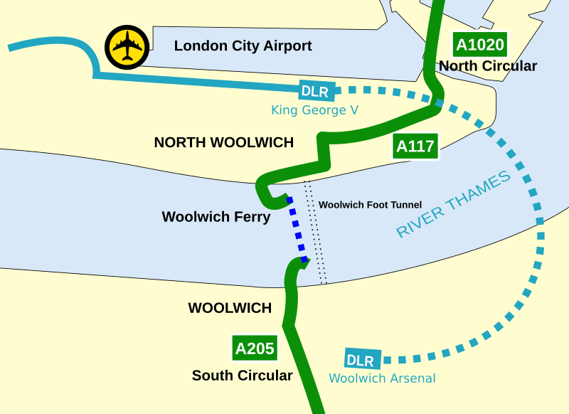
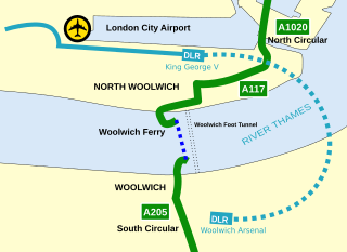
Description: A simple map showing the Woolwich Ferry crossing of the River Thames with the nearby Docklands Light Railway and London City Airport
Title: Woolwich Ferry map
Credit: Own work
Author: Cnbrb
Usage Terms: Creative Commons Attribution 3.0
License: CC BY 3.0
License Link: http://creativecommons.org/licenses/by/3.0
Attribution Required?: Yes
Image usage
The following 2 pages link to this image:

All content from Kiddle encyclopedia articles (including the article images and facts) can be freely used under Attribution-ShareAlike license, unless stated otherwise.