
Image: WorldMapLongLat-eq-circles-tropics-non
No higher resolution available.
WorldMapLongLat-eq-circles-tropics-non.png (634 × 311 pixels, file size: 93 KB, MIME type: image/png)
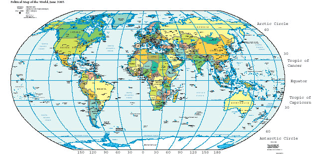
Description: Great circles of latitude. Map is a Robinson projection with standard parallels +/- 38 degrees latitude.
Title: WorldMapLongLat-eq-circles-tropics-non
Credit: Based on a screenshot of a CIA World Factbook PDF. I cropped it, added text labels, and changed file format. Niteowlneils 02:03, 9 Jun 2004 (UTC) Larger version (pdf)
Author: CIA, Niteowlneils
Usage Terms: Public domain
License: Public domain
Attribution Required?: No
Image usage
The following 3 pages link to this image:

All content from Kiddle encyclopedia articles (including the article images and facts) can be freely used under Attribution-ShareAlike license, unless stated otherwise.