
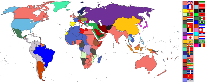
Image: World empires and colonies around World War I

Description: Taken from old colonialism wikipedia map and outlined. Dated around 1900 (shows Italian - although the flag is not correct - North Africa post 1910 and Austro-Hungarian Empire circa WW1). British territories of Canada, Australia, New Zealand and South Africa would later become dominions. Nations involved with imperialism, directly or indirectly, are coloured. Meant to portray the world around the time of WWI. In case anyone wonders, the red flag with the yellow crescent and star is the Rashidi house and their allies. Below them are the Saudis and their allies. Grey countries may be smaller empires (Nepal and Bhutan) or have extended their geopolitical boundaries over unsettled/inhabitated areas (i.e. Latin America such as Chile acquired Easter Island and the Antarctic Peninsula).
Title: World empires and colonies around World War I
Credit: Taken from wikipedia map
Author: See below.
Usage Terms: Creative Commons Attribution-Share Alike 3.0
License: CC-BY-SA-3.0
License Link: http://creativecommons.org/licenses/by-sa/3.0/
Attribution Required?: Yes
Image usage
The following 2 pages link to this image:
