
Image: World geologic provinces
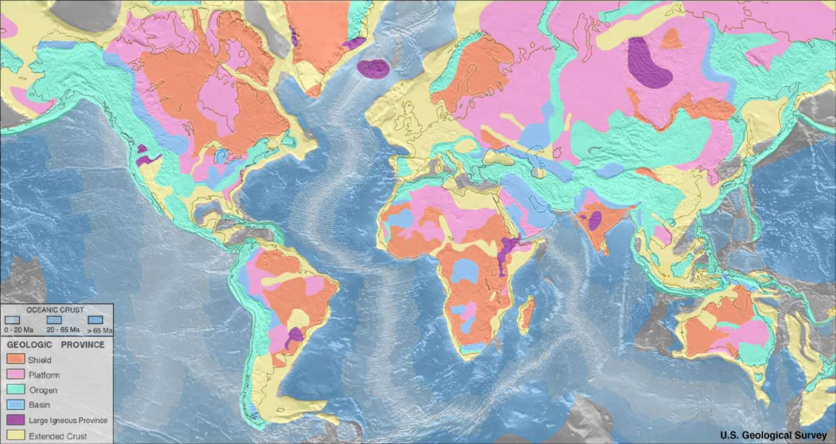
Description: Map of world geologic provinces Shield Platform Phanerozoic orogen Basin Large igneous province Extended continental crust Age of Oceanic crust: 0–20 Ma 20–65 Ma >65 Ma Important note: These geologic province map depicts only features approximately 150 km across and greater due to the fact that the resolution of the maps should be consistent with the resolution of the seismic refraction data. For example, the young uplifted blocks of the Variscan Orogen in Central and Western Europe such as the Rhenish Massif or the Massif Central are not depicted as ‘orogens’ but as part of the ‘extended continental crust’ in the western half of Europe.
Title: World geologic provinces
Credit: http://earthquake.usgs.gov/data/crust/maps.php
Author: USGS
Usage Terms: Public domain
License: Public domain
Attribution Required?: No
Image usage
The following 2 pages link to this image:
