
Image: Wpdms nasa photo san pablo bay
No higher resolution available.
Wpdms_nasa_photo_san_pablo_bay.jpg (534 × 467 pixels, file size: 91 KB, MIME type: image/jpeg)
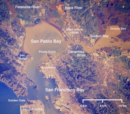
Description: Satellite picture of San Pablo Bay, Carquinez Strait, and Suisun Bay - in the Category:San Francisco Bay Area, California. © 2004 Matthew Trump, adapted from public domain NASA satellite photo.
Title: Wpdms nasa photo san pablo bay
Credit: Transferred from en.wikipedia to Commons by מתניה.
Author: The original uploader was Decumanus at English Wikipedia
Usage Terms: Creative Commons Attribution-Share Alike 3.0
License: CC-BY-SA-3.0
License Link: http://creativecommons.org/licenses/by-sa/3.0/
Attribution Required?: Yes
Image usage
The following 5 pages link to this image:

All content from Kiddle encyclopedia articles (including the article images and facts) can be freely used under Attribution-ShareAlike license, unless stated otherwise.