
Image: York Regional Forest lands

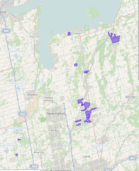
Description: Map showing the locations covered by the York Regional Forests. Self-made by the uploader using open data from York Region (http://findit.yorkmaps.ca/opendata/downloads/cache/bb/98f/bb98f9937fb96c3b_4BFE7999/379DD7596DA79391/Regional_Forest_.kmz). KML file uploaded at http://www.gpsvisualizer.com with an Open Street Map data overlay with 70% opacity.
Title: York Regional Forest lands
Credit: Own work
Author: Oaktree b
Permission: Required attribution for the KMZ data:"Contains public sector information made available under The Regional Municipality of York's Open Data Licence". See http://www.york.ca/wps/poc/york/yorkhome?1dmy&urile=wcm%3apath%3a%2FYR_Content%2FYorkConstituent%2FHome%2FYorkRegion%2FStatisticsandData%2FOpenData%2FOpenData
Usage Terms: Creative Commons Attribution-Share Alike 3.0
License: CC BY-SA 3.0
License Link: http://creativecommons.org/licenses/by-sa/3.0
Attribution Required?: Yes
Image usage
The following page links to this image:
