
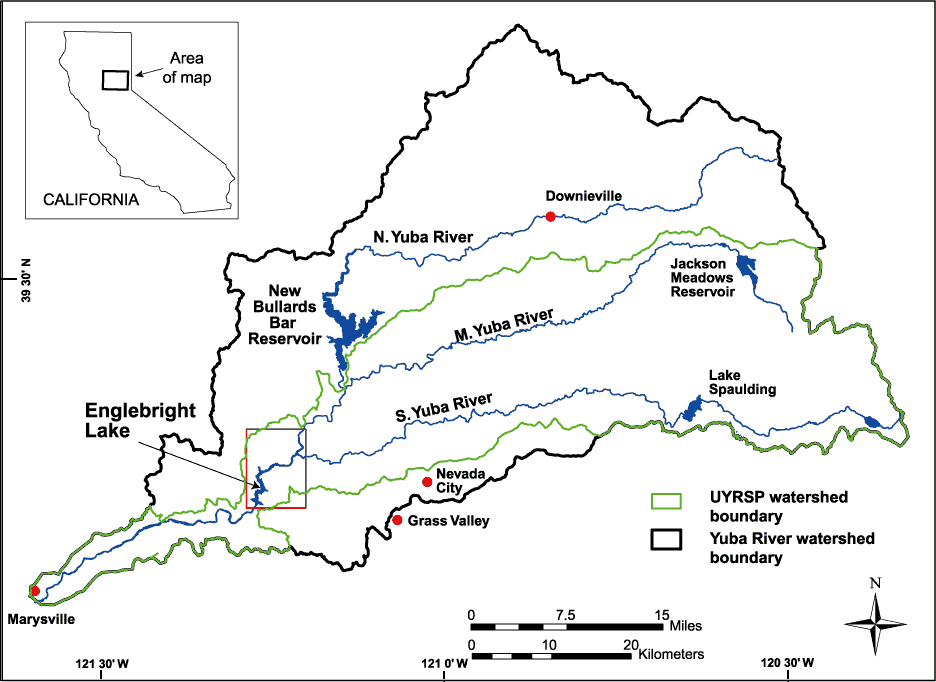
Image: Yuba river watershed
Description: Map of the watershed of the Yuba River in Nevada and Yuba Counties, California, USA. Map drawn by the U.S. Geological Service (USGS) for bathymetric and geophysical surveys of Englebright Lake, which is impounded by Englebright Dam on the Yuba River. The black borders encompass the entire watershed of the three forks of the Yuba River. The green borders encompass the limits of the USGS Upper Yuba River Watershed Studies Program (UYRSP) area. Map slightly reworked by contributor from source map and converted to PNG.
Title: Yuba river watershed
Credit: U.S. Geological Survey, Western Region Coastal and Marine Geology Image page Image description page USGS home page
Author: U.S. Geological Survey, artist not specified or unknown
Permission: This image is in the public domain in the United States because it only contains materials that originally came from the United States Geological Survey, an agency of the United States Department of the Interior. For more information, see the official USGS copyright policy.
Usage Terms: Public domain
License: Public domain
Attribution Required?: No
Image usage
The following 2 pages link to this image:
