
Image: Yugoslavia location map

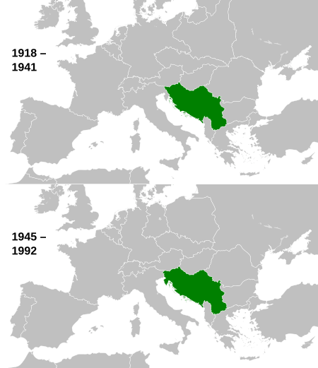
Description: This is a map of the evolution of Yugoslavia from 1918 to 1992.
Title: Yugoslavia location map
Credit: This file was derived from: ✦ History of Yugoslavia.svg: ✦ Blank map of Europe 1929-1938.svg: ✦ Blank map of Europe 1956-1990.svg: ✦ Blank map of Europe (with disputed regions).svg: ✦ Europe countries.svg:
Author: Derivative work of History_of_Yugoslavia.svg by NikNaks Portions used contain parts of: Blank_map_of_Europe_1929-1938.svg and Blank_map_of_Europe_1956-1990.svg by Alphathon. These are in turn were derived from Blank map of Europe (with disputed regions).svg by maix, W!B:, Zirland, MrWeeble, CarolSpears, TimothyBourke, Collard, F7, Alphathon and Heb) This itself is derived from Europe_countries.svg by Tintazul derivative work: Alphathon
Usage Terms: Creative Commons Attribution-Share Alike 3.0
License: CC BY-SA 3.0
License Link: https://creativecommons.org/licenses/by-sa/3.0
Attribution Required?: Yes
Image usage
The following page links to this image:
