
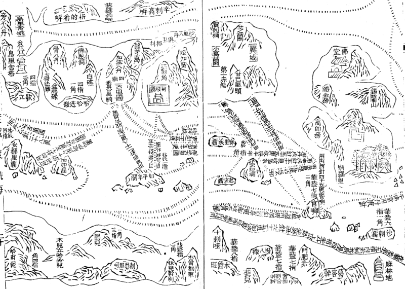
Image: Zhenghe-sailing-chart

Size of this preview: 800 × 570 pixels. Other resolutions: 320 × 228 pixels | 1,454 × 1,036 pixels.
Original image (1,454 × 1,036 pixels, file size: 174 KB, MIME type: image/gif)
Description: Part of the Wu bei zhi chart of Zheng He showing the west coast of India along the top, Ceylon top right and Africa along the bottom. The sailing directions are shown using zhen lu compass directions.
Title: Zhenghe-sailing-chart
Credit: Wubei Zhi
Usage Terms: Public domain
License: Public domain
Attribution Required?: No
Image usage
The following 2 pages link to this image:

All content from Kiddle encyclopedia articles (including the article images and facts) can be freely used under Attribution-ShareAlike license, unless stated otherwise.