
National Register of Historic Places listings in San Luis Obispo County, California facts for kids

This is a list of the National Register of Historic Places listings in San Luis Obispo County, California.
This is intended to be a complete list of the properties and districts on the National Register of Historic Places in San Luis Obispo County, California, United States. Latitude and longitude coordinates are provided for many National Register properties and districts; these locations may be seen together in an online map.
There are 37 properties and districts listed on the National Register in the county, including 3 National Historic Landmarks.
Current listings
| Name on the Register | Image | Date listed | Location | City or town | Description | |
|---|---|---|---|---|---|---|
| 1 | Administration Building, Atascadero Colony |
 |
(#77000336) |
6500 Palma Ave. 35°29′23″N 120°39′58″W / 35.489722°N 120.666111°W |
Atascadero | |
| 2 | Ah Louis Store |
 |
(#08000203) |
800 Palm St. 35°16′58″N 120°39′49″W / 35.282778°N 120.663611°W |
San Luis Obispo | |
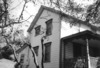
| 3 | Myron Angel House |
 |
(#82000988) |
714 Buchon St. 35°16′33″N 120°39′39″W / 35.275833°N 120.660833°W |
San Luis Obispo | |
| 4 | Archeological Site 4 SLO 834 |
(#82004618) |
Address Restricted |
Atascadero | ||
| 5 | Arroyo Grande IOOF Hall |
 |
(#91000344) |
128 Bridge St. 35°07′20″N 120°34′38″W / 35.122222°N 120.577222°W |
Arroyo Grande | |
| 6 | Atascadero Printery |
 |
(#00001368) |
6351 Olmeda 35°29′32″N 120°39′56″W / 35.492222°N 120.665556°W |
Atascadero | |
| 7 | Bank of Italy |
 |
(#98000245) |
1245 Park St. 35°37′39″N 120°41′21″W / 35.6275°N 120.689167°W |
Paso Robles | |
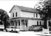
| 8 | Brewster-Dutra House |
(#82000989) |
1803 Vine St. 35°37′59″N 120°41′37″W / 35.633056°N 120.693611°W |
Paso Robles | ||
| 9 | Caledonia Adobe |
 |
(#71000190) |
0.5 mi. S of 10th St. 35°44′17″N 120°41′56″W / 35.738056°N 120.698889°W |
San Miguel | |
| 10 | Call-Booth House |
 |
(#88002031) |
1315 Vine St. 35°37′40″N 120°41′35″W / 35.627778°N 120.693056°W |
Paso Robles | |
| 11 | Carrizo Plain Rock Art Discontiguous District |
 |
(#01000509) |
Address Restricted |
California Valley | designated the Carrizo Plain Archeological District National Historic Landmark District March 2, 2012 |
| 12 | Corral de Piedra |
|
(#78000766) |
S of San Luis Obispo on Price Canyon Rd. 35°11′37″N 120°37′28″W / 35.193611°N 120.624444°W |
San Luis Obispo | |
| 13 | Dana Adobe |
 |
(#71000189) |
S end of Oak Glen Ave. 35°01′40″N 120°31′40″W / 35.027778°N 120.527778°W |
Nipomo | |
| 14 | Eight Mile House |
 |
(#95000358) |
Off CA 101 on Stagecoach Rd. 35°22′02″N 120°38′17″W / 35.367222°N 120.638056°W |
Santa Margarita | |
| 15 | Guthrie House |
(#80000853) |
Burton and Center Sts. 35°33′49″N 121°04′52″W / 35.563611°N 121.081111°W |
Cambria | ||
| 16 | Hearst San Simeon Estate |
 |
(#72000253) |
3 mi. NE of San Simeon 35°41′06″N 121°10′07″W / 35.685°N 121.168611°W |
San Simeon | |
| 17 | Robert Jack House |
 |
(#92000312) |
536 Marsh St. 35°16′38″N 120°39′53″W / 35.277222°N 120.664722°W |
San Luis Obispo | |
| 18 | Lincoln School |
(#01001244) |
9000 Chimney Rock Rd. 35°40′05″N 120°51′18″W / 35.668056°N 120.855°W |
Paso Robles | ||
| 19 | Mission San Miguel Arcangel |
 |
(#71000191) |
801 Mission Street (old CA 101) 35°37′59″N 120°41′37″W / 35.633056°N 120.693611°W |
San Miguel | |
| 20 | Monday Club of San Luis Obispo |
 |
(#16000230) |
1815 Monterey St. 35°17′19″N 120°39′05″W / 35.288551°N 120.651366°W |
San Luis Obispo | |
| 21 | MONTEBELLO (shipwreck and remains) |
(#16000636) |
Off the coast 35°35′00″N 121°16′00″W / 35.583333°N 121.266667°W |
Cambria | ||
| 22 | Morro Bay State Park Trailer and Tent Campground |
(#14000852) |
20 State Park Rd. 35°20′49″N 120°50′19″W / 35.34692°N 120.838677°W |
Morro Bay | ||
| 23 | Old Santa Rosa Catholic Church and Cemetery |
(#82000990) |
Main St. 35°33′58″N 121°04′48″W / 35.566111°N 121.08°W |
Cambria | ||
| 24 | Pacific Coast Railway Company Grain Warehouse |
 |
(#88000921) |
65 Higuera St. 35°16′22″N 120°39′54″W / 35.272778°N 120.665°W |
San Luis Obispo | |
| 25 | Paso Robles Almond Growers Association Warehouse |
(#16000095) |
525 Riverside Ave. 35°37′13″N 120°41′13″W / 35.620182°N 120.686836°W |
Paso Robles | ||
| 26 | Paso Robles Carnegie Library |
 |
(#97001635) |
City Park, 800 12th St. 35°37′33″N 120°41′20″W / 35.625833°N 120.688889°W |
Paso Robles | |
| 27 | Pereira Octagon Barn |
 |
(#13001068) |
4400 Octagon Wy. 35°14′13″N 120°40′47″W / 35.236927°N 120.679602°W |
San Luis Obispo | |
| 28 | Piedras Blancas Light Station |
 |
(#91001095) |
CA 1 on Point Piedras Blancas 35°39′57″N 121°17′02″W / 35.665833°N 121.283889°W |
San Simeon | |
| 29 | Port San Luis Site |
 |
(#78000767) |
Address Restricted |
San Luis Obispo | |
| 30 | The Powerhouse |
 |
(#93000670) |
Jct. of S. Perimeter Rd. and Cuesta Ave., NE corner 35°17′57″N 120°39′45″W / 35.299167°N 120.6625°W |
San Luis Obispo | |
| 31 | John Price House |
 |
(#88002013) |
Highland Dr. off Price Canyon Rd. 35°08′52″N 120°38′20″W / 35.147778°N 120.638889°W |
Pismo Beach | |
| 32 | Rancho Canada de los Osos y Pecho y Islay |
 |
(#75000477) |
Address Restricted |
Los Osos | |
| 33 | San Luis Obispo Carnegie Library |
 |
(#95000357) |
696 Monterey St. 35°16′49″N 120°39′50″W / 35.280278°N 120.663889°W |
San Luis Obispo | |
| 34 | San Luis Obispo Light Station |
 |
(#91001093) |
Point San Luis 35°09′42″N 120°45′26″W / 35.161667°N 120.757222°W |
Avila Beach | |
| 35 | William Shipsey House |
 |
(#10000115) |
1266 Mill St. 35°17′09″N 120°39′32″W / 35.285797°N 120.658967°W |
San Luis Obispo | |
| 36 | Tribune-Republic Building |
 |
(#93000548) |
1763 Santa Barbara St. 35°16′33″N 120°39′21″W / 35.275833°N 120.655833°W |
San Luis Obispo |

All content from Kiddle encyclopedia articles (including the article images and facts) can be freely used under Attribution-ShareAlike license, unless stated otherwise. Cite this article:
National Register of Historic Places listings in San Luis Obispo County, California Facts for Kids. Kiddle Encyclopedia.