List of places on the Victorian Heritage Register in the City of Hume facts for kids
This is a list of places on the Victorian Heritage Register in the City of Hume in Victoria, Australia. The Victorian Heritage Register is maintained by the Heritage Council of Victoria.
The Victorian Heritage Register, as of 2020, lists the following 17 state-registered places within the City of Hume:
| Place name | Place # | Location | Suburb or Town | Co-ordinates | Built | State registered |
Photo |
|---|---|---|---|---|---|---|---|
| Arundel Road Trestle Bridge | H1952 | over the Maribyrnong River | Keilor | 37°42′14″S 144°49′58″E / 37.703910°S 144.832770°E | 1906-07 | 13 September 2001 | |
| Bluestone Bridge over Jackson Creek | H1426 | Sunbury Rd over Jackson Creek | Sunbury | 37°35′02″S 144°44′29″E / 37.583990°S 144.741350°E | 1870 | 20 August 1982 | |
| Bluestone Bridge over Moonee Ponds Creek | H1455 | Fawkner St over Moonee Ponds Creek | Westmeadows | 37°40′35″S 144°53′16″E / 37.676370°S 144.887680°E | 1869 | 20 August 1982 |  |
| Bulla Primary School | H1643 | 11 School Lane | Bulla | 37°38′09″S 144°47′47″E / 37.635870°S 144.796250°E | 1870-71 | 20 August 1982 | |
| Craiglee Winery | H0677 | 785 Sunbury Rd | Sunbury | 37°40′35″S 144°53′16″E / 37.676370°S 144.887680°E | 1865-68 | 23 December 1987 | |
| Emu Bottom Homestead | H0274 | 410 Racecourse Rd | Sunbury | 37°32′22″S 144°44′04″E / 37.539417°S 144.734500°E | c. 1836 | 9 October 1974 | |
| Glenara | H0625 | 10 Glenara Dve | Bulla | 37°38′36″S 144°48′29″E / 37.643460°S 144.808160°E | 1857 | 1 October 1986 | |
| Manor House | H1181 | 1 Eldon St | Broadmeadows | 37°41′24″S 144°57′01″E / 37.690090°S 144.950140°E | c. 1850 | 18 April 1996 | |
| Mount Ridley Homestead | H2246 | 100 Mt Ridley Rd | Mickleham | 37°34′02″S 144°55′55″E / 37.567170°S 144.932080°E | 1848-50 | 8 December 2011 | |
| Rail Bridge over Blind Creek | H1441 | over Blind Creek | Sunbury | 37°34′22″S 144°44′00″E / 37.572880°S 144.733390°E | c. 1859 | 20 August 1982 | |
| Macedon Street Bridge | H1694 | Macedon Street over the Bendigo railway line |
Sunbury | 37°34′35″S 144°43′48″E / 37.576250°S 144.730120°E | 1861 | 20 August 1982 | |
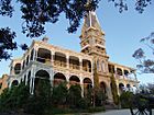
| Rupertswood | H0275 | 3-5 Macedon St | Sunbury | 37°34′22″S 144°44′13″E / 37.572840°S 144.736910°E | 1874-76 | 9 October 1974 |  |
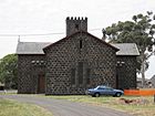
| Scots Uniting Church | H0127 | 1702-1708 Sydney Rd | Campbellfield | 37°40′32″S 144°57′27″E / 37.675490°S 144.957530°E | 1855 | 9 October 1974 |  |
| Sunbury Hill Railway Bridge | H1964 | over a tributary of Jackson Creek | Sunbury | 37°35′59″S 144°43′05″E / 37.599760°S 144.718180°E | c. 1859 | 21 December 2001 | |
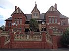
| Sunbury Asylum | H0937 | Circular Dve | Sunbury | 37°35′36″S 144°43′44″E / 37.593370°S 144.729020°E | 1865 | 20 August 1982 |  |
| Water Tower | H1673 | Sunbury railway station 1 Brook St |
Sunbury | 37°34′45″S 144°43′40″E / 37.579230°S 144.727740°E | 1861 | 20 August 1982 | |
| Woodlands Homestead | H1612 | Woodlands Dve | Greenvale | 37°38′19″S 144°50′35″E / 37.638680°S 144.843010°E | 1843-46 | 9 October 1974 |

All content from Kiddle encyclopedia articles (including the article images and facts) can be freely used under Attribution-ShareAlike license, unless stated otherwise. Cite this article:
List of places on the Victorian Heritage Register in the City of Hume Facts for Kids. Kiddle Encyclopedia.
