Mine Hill Township, New Jersey facts for kids
Quick facts for kids
Mine Hill Township, New Jersey
|
|
|---|---|
|
Township
|
|
| Township of Mine Hill | |

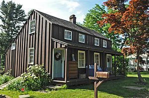
Bridget Smith House
|
|

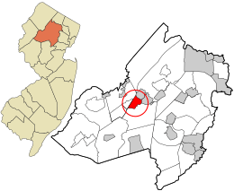
Location in Morris County and the state of New Jersey.
|
|

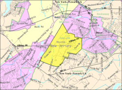
Census Bureau map of Mine Hill Township, New Jersey
|
|
| Country | |
| State | |
| County | |
| Incorporated | May 8, 1923 |
| Government | |
| • Type | Faulkner Act (mayor–council) |
| • Body | Township Council |
| Area | |
| • Total | 3.00 sq mi (7.76 km2) |
| • Land | 2.94 sq mi (7.61 km2) |
| • Water | 0.06 sq mi (0.15 km2) 1.93% |
| Area rank | 335th of 565 in state 26th of 39 in county |
| Elevation | 866 ft (264 m) |
| Population | |
| • Total | 3,651 |
| • Estimate
(2019)
|
3,478 |
| • Rank | 425th of 566 in state 35th of 39 in county |
| • Density | 1,241.6/sq mi (479.4/km2) |
| • Density rank | 355th of 566 in state 23rd of 39 in county |
| Time zone | UTC−05:00 (Eastern (EST)) |
| • Summer (DST) | UTC−04:00 (Eastern (EDT)) |
| ZIP Code |
07803
|
| Area code(s) | 973 |
| FIPS code | 3402746860 |
| GNIS feature ID | 0882202 |
Mine Hill Township is a township in Morris County, New Jersey, United States. It is a residential community located just west of the center of Morris County, and northwest of the county seat Morristown.
Mine Hill was incorporated as a township by an act of the New Jersey Legislature on March 2, 1923, from portions of Randolph Township, based on the results of a referendum held on May 8, 1923.
The township's name comes from the history of mines in the area. Mining in Mine Hill dates back to the early 18th century and the township had some of the richest sources of iron ore in the country. Mahlon Dickerson, who was New Jersey's 12th Governor, and his family owned the Dickerson Mine, which was the largest ore mine in the area, supplying much of the iron ore used during the American Revolutionary War. The last mine in the township closed in the late 1960s.
At the 2010 United States Census, the township's population was 3,651, reflecting a decline of 28 (-0.8%) from the 3,679 counted in the 2000 Census, which had in turn increased by 346 (+10.4%) from the 3,333 counted in the 1990 Census.
Contents
Geography
According to the United States Census Bureau, the township had a total area of 3.031 square miles (7.850 km2), including 2.941 square miles (7.616 km2) of land and 0.090 square miles (0.234 km2) of water (2.98%).
Demographics
| Historical population | |||
|---|---|---|---|
| Census | Pop. | %± | |
| 1930 | 1,422 | — | |
| 1940 | 1,541 | 8.4% | |
| 1950 | 1,951 | 26.6% | |
| 1960 | 3,362 | 72.3% | |
| 1970 | 3,557 | 5.8% | |
| 1980 | 3,325 | −6.5% | |
| 1990 | 3,333 | 0.2% | |
| 2000 | 3,679 | 10.4% | |
| 2010 | 3,651 | −0.8% | |
| 2019 (est.) | 3,478 | −4.7% | |
| Population sources: 1930 1930-1990 2000 2010 |
|||
Census 2010
As of the census of 2010, there were 3,651 people, 1,329 households, and 977 families residing in the township. The population density was 1,241.6 per square mile (479.4/km2). There were 1,380 housing units at an average density of 469.3 per square mile (181.2/km2)*. The racial makeup of the township was 80.69% (2,946) White, 4.60% (168) Black or African American, 0.41% (15) Native American, 4.96% (181) Asian, 0.03% (1) Pacific Islander, 5.78% (211) from other races, and 3.53% (129) from two or more races. [[Hispanic (U.S. Census)|Hispanic or Latino of any race were 23.01% (840) of the population.
There were 1,329 households out of which 31.8% had children under the age of 18 living with them, 57.7% were married couples living together, 9.9% had a female householder with no husband present, and 26.5% were non-families. 20.3% of all households were made up of individuals, and 7.2% had someone living alone who was 65 years of age or older. The average household size was 2.75 and the average family size was 3.16.
In the township, the population was spread out with 22.6% under the age of 18, 7.0% from 18 to 24, 27.6% from 25 to 44, 30.6% from 45 to 64, and 12.2% who were 65 years of age or older. The median age was 40.3 years. For every 100 females there were 97.0 males. For every 100 females ages 18 and old there were 96.3 males. The Census Bureau's 2006-2010 American Community Survey showed that (in 2010 inflation-adjusted dollars) median household income was $91,667 (with a margin of error of +/- $17,591) and the median family income was $103,532 (+/- $8,317). Males had a median income of $61,875 (+/- $13,249) versus $42,201 (+/- $13,280) for females. The per capita income for the township was $36,706 (+/- $3,887). About 2.4% of families and 3.3% of the population were below the poverty line, including none of those under age 18 and 5.2% of those age 65 or over.
Library services
The Mine Hill Township Library is located at the Civic Center. Residents may also use either the County College of Morris Library in Randolph or the Morris County Library in Morris Plains. Residents of Mine Hill cannot use any other local library in Morris County, because the township does not belong to the Morris County Library System.
Transportation
Roads and highways
As of May 2010[update], the township had a total of 20.65 miles (33.23 km) of roadways, of which 15.89 miles (25.57 km) were maintained by the municipality, 2.86 miles (4.60 km) by Morris County and 1.90 miles (3.06 km) by the New Jersey Department of Transportation.
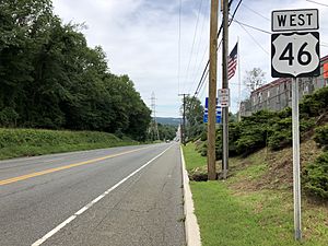
U.S. Route 46 is the main highway serving Mine Hill Township. Interstate 80 and New Jersey Route 10 are accessible in adjacent municipalities.
Public transportation
NJ Transit provides Midtown Direct service at the Dover train station on the Montclair-Boonton Line and the Morristown Line to Newark Broad Street station, Secaucus Junction, New York Penn Station and Hoboken Terminal.
NJ Transit offered local bus service on the MCM5 route, which was eliminated in 2010 when subsidies to the local provider were eliminated as part of budget cuts.
Education
The Mine Hill School District serves students in pre-kindergarten through sixth grade at Canfield Avenue School. As of the 2018–19 school year, the district, comprised of one school, had an enrollment of 347 students and 34.0 classroom teachers (on an FTE basis), for a student–teacher ratio of 10.2:1.
During the 1991–92 school year, Canfield Avenue School was recognized with the National Blue Ribbon School Award from the United States Department of Education, the highest honor that an American school can achieve.
For seventh through twelfth grades, public school students attend the schools of the Dover School District in Dover as part of a sending/receiving relationship. The district also serves students from Victory Gardens, which has been fully consolidated into the Dover School District since 2010. The high school was recognized with the National Blue Ribbon School Award in 2013. Schools in the Dover School District attended by Mine Hill students (with 2018–19 enrollment from the National Center for Education Statistics) are Dover Middle School with 511 students in grade 7-8 and Dover High School with 983 stundets in grades 9-12.
Notable people
People who were born in, residents of, or otherwise closely associated with Mine Hill Township include:
- Kathleen Clark, playwright.
- Tim DiBisceglie (born 1994), professional soccer player who played for the Philadelphia Atoms in 2017–19.
- BettyLou DeCroce (born 1952), politician who has served in the New Jersey General Assembly since 2012, where she has represented the 26th Legislative District, who served on the Mine Hill Township Council from 1981 to 1983.
See also
 In Spanish: Municipio de Mine Hill (Nueva Jersey) para niños


