National Register of Historic Places listings in Cherokee County, North Carolina facts for kids
This list includes properties and districts listed on the National Register of Historic Places in Cherokee County, North Carolina. Click the "Map of all coordinates" link to the right to view an online map of all properties and districts with latitude and longitude coordinates in the table below.
Current listings
| Name on the Register | Image | Date listed | Location | City or town | Description | |
|---|---|---|---|---|---|---|
| 1 | John C. Campbell Folk School Historic District |
(#83001839) |
Off U.S. Route 64 35°02′10″N 83°57′54″W / 35.036111°N 83.965°W |
Brasstown | ||
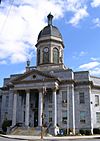
| 2 | Cherokee County Courthouse |
(#79001692) |
Peachtree and Central Sts. 35°05′12″N 84°01′59″W / 35.086667°N 84.033056°W |
Murphy | ||
| 3 | John Franklin Cobb House |
(#84000074) |
U.S. Routes 19/129 35°00′07″N 84°05′04″W / 35.001944°N 84.084444°W |
Bell View | ||
| 4 | Robert Lafayette Cooper House |
(#90001372) |
70 Campbell St. 35°05′14″N 84°01′50″W / 35.087154°N 84.030507°W |
Murphy | ||
| 5 | Franklin Pierce Cover House |
(#82001293) |
NC 1388 35°12′07″N 83°49′37″W / 35.201893°N 83.826953°W |
Andrews | ||
| 6 | First Baptist Church |
(#02000962) |
101 Chestnut St. 35°12′00″N 83°49′31″W / 35.200090°N 83.825178°W |
Andrews | ||
| 7 | Harshaw Chapel and Cemetery |
(#84001979) |
Church and Central Sts. 35°05′07″N 84°02′01″W / 35.085278°N 84.033611°W |
Murphy | ||
| 8 | Walker's Inn |
(#75001247) |
South of Andrews on NC 1505 off NC 19 and 1393 35°11′35″N 83°48′16″W / 35.193056°N 83.804444°W |
Andrews |

All content from Kiddle encyclopedia articles (including the article images and facts) can be freely used under Attribution-ShareAlike license, unless stated otherwise. Cite this article:
National Register of Historic Places listings in Cherokee County, North Carolina Facts for Kids. Kiddle Encyclopedia.


