National Register of Historic Places listings in Hoonah–Angoon Census Area, Alaska facts for kids
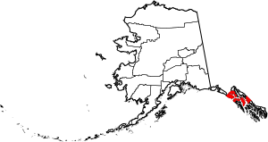
This is a list of the National Register of Historic Places listings in Hoonah–Angoon Census Area, Alaska.
This is intended to be a complete list of the properties and districts on the National Register of Historic Places in Hoonah-Angoon Census Area, Alaska, United States. The locations of National Register properties and districts for which the latitude and longitude coordinates are included below, may be seen in a Google map.
There are 20 properties and districts listed on the National Register in the census area.
Current listings
| Name on the Register | Image | Date listed | Location | City or town | Description | |
|---|---|---|---|---|---|---|
| 1 | Alexander Lake Shelter Cabin |
(#95001296) |
Admiralty Island National Monument 57°39′47″N 134°08′31″W / 57.663056°N 134.141944°W |
Angoon | ||
| 2 | Beaver Lake Dam |
(#95001295) |
Admiralty Island National Monument 57°40′30″N 134°13′07″W / 57.675°N 134.218611°W |
Angoon | ||
| 3 | Big Shaheen Cabin |
(#95001292) |
Admiralty Island National Monument 57°42′07″N 134°16′28″W / 57.701944°N 134.274444°W |
Angoon | ||
| 4 | Davidson Lake Shelter Cabin |
(#95001303) |
Admiralty Island National Monument 57°36′17″N 134°22′39″W / 57.604722°N 134.3775°W |
Angoon | ||
| 5 | Distin Lake Shelter Cabin |
(#95001294) |
Admiralty Island National Monument 57°26′59″N 134°24′13″W / 57.449722°N 134.403611°W |
Angoon | ||
| 6 | Hasselborg Cabin |
(#95001291) |
Admiralty Island National Monument 58°32′40″N 134°04′42″W / 58.544444°N 134.078333°W |
Angoon | ||
| 7 | Hasselborg Lake East Shelter Cabin |
(#95001308) |
Admiralty Island National Monument 57°40′05″N 134°12′50″W / 57.668056°N 134.213889°W |
Angoon | ||
| 8 | Hasselborg Lake North Shelter Cabin |
(#95001307) |
Admiralty Island National Monument 57°46′02″N 134°19′09″W / 57.767222°N 134.319167°W |
Angoon | ||
| 9 | Hasselborg Lake South Shelter Cabin |
(#95001300) |
Admiralty Island National Monument 57°39′52″N 134°15′15″W / 57.6645°N 134.2541°W |
Angoon | ||
| 10 | Lake Guerin East Shelter Cabin |
(#95001306) |
Admiralty Island National Monument 57°39′37″N 134°17′04″W / 57.660278°N 134.284444°W |
Angoon | ||
| 11 | Lake Guerin West Shelter Cabin |
(#95001301) |
Admiralty Island National Monument 57°38′58″N 134°20′24″W / 57.649444°N 134.34°W |
Angoon | ||
| 12 | Mitchell Bay Shelter Cabin |
(#95001302) |
Admiralty Island National Monument 57°33′53″N 134°23′48″W / 57.564722°N 134.396667°W |
Angoon | ||
| 13 | Mole Harbor Shelter Cabin |
(#95001297) |
Admiralty Island National Monument 57°39′36″N 134°05′54″W / 57.66°N 134.098333°W |
Angoon | ||
| 14 | Point Retreat Light Station |
(#03000529) |
On the Mansfield Peninsula at the northern end of Admiralty Island, near the junction of Lynn Canal and Stephens Passage 58°24′40″N 134°57′11″W / 58.411111°N 134.953056°W |
Juneau | ||
| 15 | St. John the Baptist Church |
(#80004589) |
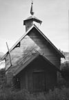
In Angoon 57°30′14″N 134°35′03″W / 57.503889°N 134.584167°W |
Angoon | Russian Orthodox Church | |
| 16 | Thayer Lake East Shelter Cabin |
(#95001309) |
Admiralty Island National Monument 57°38′03″N 134°27′45″W / 57.634167°N 134.4625°W |
Angoon | ||
| 17 | Thayer Lake North Shelter Cabin |
(#95001304) |
Admiralty Island National Monument 57°41′24″N 134°24′35″W / 57.69°N 134.409722°W |
Angoon | ||
| 18 | Thayer Lake South Shelter Cabin |
(#95001298) |
Admiralty Island National Monument 57°35′52″N 134°28′05″W / 57.597778°N 134.468056°W |
Angoon | ||
| 19 | Windfall Harbor Shelter Cabin |
(#95001299) |
Admiralty Island National Monument 57°50′11″N 134°18′22″W / 57.836389°N 134.306111°W |
Angoon | CCC Historic Properties in Alaska MPS; proposed move approved December 6, 2010 |

All content from Kiddle encyclopedia articles (including the article images and facts) can be freely used under Attribution-ShareAlike license, unless stated otherwise. Cite this article:
National Register of Historic Places listings in Hoonah–Angoon Census Area, Alaska Facts for Kids. Kiddle Encyclopedia.


