
Toms Brook, Virginia facts for kids
Quick facts for kids
Toms Brook, Virginia
|
|
|---|---|

St. Peter's Lutheran Church (1904)
|
|

Location of Toms Brook, Virginia
|
|
| Country | United States |
| State | Virginia |
| County | Shenandoah |
| Area | |
| • Total | 0.13 sq mi (0.33 km2) |
| • Land | 0.13 sq mi (0.33 km2) |
| • Water | 0.00 sq mi (0.00 km2) |
| Elevation | 702 ft (214 m) |
| Population
(2010)
|
|
| • Total | 258 |
| • Estimate
(2019)
|
272 |
| • Density | 2,158.73/sq mi (832.95/km2) |
| Time zone | UTC−5 (Eastern (EST)) |
| • Summer (DST) | UTC−4 (EDT) |
| ZIP code |
22660
|
| Area code(s) | 540 |
| FIPS code | 51-79024 |
| GNIS feature ID | 1500231 |
Toms Brook is a town in Shenandoah County, Virginia, United States. The population was 258 at the 2010 census.
History

During the American Civil War, the Battle of Tom's Brook was fought nearby, a Union victory that became dubbed "the Woodstock Races."
The Toms Brook School was listed on the National Register of Historic Places in 2011.
Geography
Toms Brook is located at 38°56′50″N 78°26′23″W / 38.94722°N 78.43972°W (38.947214, -78.439657).
According to the United States Census Bureau, the town has a total area of 0.2 square miles (0.4 km²), all of it land.
Climate
The climate in this area is characterized by hot, humid summers and generally mild to cool winters. According to the Köppen Climate Classification system, Toms Brook has a humid subtropical climate, abbreviated "Cfa" on climate maps.
Demographics
| Historical population | |||
|---|---|---|---|
| Census | Pop. | %± | |
| 1860 | 598 | — | |
| 1930 | 240 | — | |
| 1940 | 219 | −8.7% | |
| 1950 | 256 | 16.9% | |
| 1960 | 244 | −4.7% | |
| 1970 | 258 | 5.7% | |
| 1980 | 226 | −12.4% | |
| 1990 | 227 | 0.4% | |
| 2000 | 255 | 12.3% | |
| 2010 | 258 | 1.2% | |
| 2019 (est.) | 272 | 5.4% | |
| U.S. Decennial Census | |||
At the 2000 census there were 255 people, 100 households, and 70 families living in the town. The population density was 1,652.4 people per square mile (656.4/km2). There were 103 housing units at an average density of 667.4 per square mile (265.1/km2). The racial makeup of the town was 94.90% White, 1.18% African American, 0.78% Native American, 0.39% from other races, and 2.75% from two or more races. Hispanic or Latino of any race were 0.78%.
Of the 100 households 30.0% had children under the age of 18 living with them, 53.0% were married couples living together, 12.0% had a female householder with no husband present, and 30.0% were non-families. 24.0% of households were one person and 10.0% were one person aged 65 or older. The average household size was 2.55 and the average family size was 3.07.
The age distribution was 22.4% under the age of 18, 9.4% from 18 to 24, 32.5% from 25 to 44, 26.3% from 45 to 64, and 9.4% 65 or older. The median age was 37 years. For every 100 females, there were 90.3 males. For every 100 females age 18 and over, there were 90.4 males.
The median household income was $38,214 and the median family income was $44,688. Males had a median income of $27,750 versus $20,972 for females. The per capita income for the town was $16,712. About 2.5% of families and 5.9% of the population were below the poverty line, including 3.4% of those under the age of eighteen and none of those sixty five or over.
Transportation
U.S. Route 11 is the only significant highway directly serving Toms Brook. US 11 serves as a local service road for nearby Interstate 81. The closest interchange on I-81 is Exit 291, which connects to Toms Brook via US 11 and Mount Olive Road (SR 651).
Images for kids
-
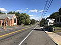
US 11 in Toms Brook
_just_south_of_Toms_Brook_Drive_in_Toms_Brook,_Shenandoah_County,_Virginia.jpg)
See also
 In Spanish: Toms Brook (Virginia) para niños
