Waitsfield, Vermont facts for kids
Quick facts for kids
Waitsfield, Vermont
|
|
|---|---|
|
Town
|
|

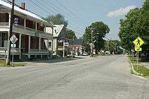
Downtown Waitsfield, Vermont
|
|

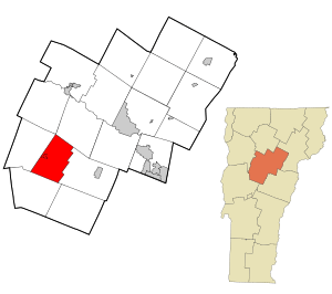
Location in Washington County and the state of Vermont
|
|

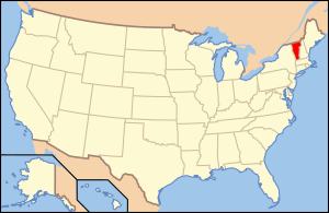
Location of Vermont with the U.S.A.
|
|
| Country | United States |
| State | Vermont |
| County | Washington |
| Chartered | 1782 (Vermont) |
| Communities |
|
| Area | |
| • Total | 26.9 sq mi (69.7 km2) |
| • Land | 26.7 sq mi (69.2 km2) |
| • Water | 0.2 sq mi (0.5 km2) |
| Elevation | 800 ft (306 m) |
| Population
(2020)
|
|
| • Total | 1,844 |
| • Density | 68.52/sq mi (26.456/km2) |
| Time zone | UTC-5 (EST) |
| • Summer (DST) | UTC-4 (EDT) |
| ZIP code |
05673
|
| Area code(s) | 802 |
| FIPS code | 50-75325 |
| GNIS feature ID | 1462237 |
Waitsfield is a small town in Washington County, Vermont, United States. It's a part of the beautiful New England region. In 2020, about 1,844 people lived here.
The town was officially created on February 25, 1782. It was given to some important military leaders, including General Benjamin Wait. The town was named after him.
Contents
Exploring Waitsfield's Location
Waitsfield is located in a lovely valley. This valley is formed by the Mad River. On one side, you have the tall Green Mountains. On the other side are the Northfield Mountains.
How Big is Waitsfield?
The town covers a total area of about 69.7 square kilometers (26.9 square miles). Most of this area, about 69.2 square kilometers (26.7 square miles), is land. Only a small part, 0.5 square kilometers (0.2 square miles), is water.
Roads and Villages
Vermont Route 100 is a main road that goes through the valley. It connects Waitsfield to other towns like Waterbury to the north and Warren to the south. Another road, Vermont Route 17, heads west from Route 100. It goes over the Green Mountains, past the Mad River Glen ski area.
The main villages in Waitsfield are called Waitsfield and Irasville. Both are located along Route 100. There's also a place called Waitsfield Common, which is near the center of the town.
Waitsfield's Weather
| Climate data for Waitsfield, Vermont, 1991–2020 normals: 1142ft (348m) | |||||||||||||
|---|---|---|---|---|---|---|---|---|---|---|---|---|---|
| Month | Jan | Feb | Mar | Apr | May | Jun | Jul | Aug | Sep | Oct | Nov | Dec | Year |
| Mean daily maximum °F (°C) | 27.6 (−2.4) |
30.2 (−1.0) |
37.7 (3.2) |
51.1 (10.6) |
64.0 (17.8) |
72.3 (22.4) |
77.2 (25.1) |
75.7 (24.3) |
68.8 (20.4) |
55.0 (12.8) |
44.0 (6.7) |
33.3 (0.7) |
53.1 (11.7) |
| Daily mean °F (°C) | 18.9 (−7.3) |
20.9 (−6.2) |
28.4 (−2.0) |
41.0 (5.0) |
53.3 (11.8) |
61.8 (16.6) |
66.4 (19.1) |
64.9 (18.3) |
57.6 (14.2) |
45.7 (7.6) |
35.7 (2.1) |
25.6 (−3.6) |
43.4 (6.3) |
| Mean daily minimum °F (°C) | 10.2 (−12.1) |
11.5 (−11.4) |
19.1 (−7.2) |
30.9 (−0.6) |
42.5 (5.8) |
51.3 (10.7) |
55.6 (13.1) |
54.1 (12.3) |
46.3 (7.9) |
36.3 (2.4) |
27.3 (−2.6) |
17.9 (−7.8) |
33.6 (0.9) |
| Average precipitation inches (mm) | 3.41 (87) |
3.01 (76) |
3.53 (90) |
3.63 (92) |
4.35 (110) |
4.57 (116) |
5.24 (133) |
4.71 (120) |
4.38 (111) |
5.42 (138) |
3.56 (90) |
4.41 (112) |
50.22 (1,275) |
| Average snowfall inches (cm) | 26.90 (68.3) |
27.20 (69.1) |
25.00 (63.5) |
6.10 (15.5) |
0.00 (0.00) |
0.00 (0.00) |
0.00 (0.00) |
0.00 (0.00) |
0.00 (0.00) |
0.90 (2.3) |
7.00 (17.8) |
24.60 (62.5) |
117.7 (299) |
| Source 1: NOAA | |||||||||||||
| Source 2: NOAA (Waitsfield 2 W precipitation & snowfall) | |||||||||||||
Schools in Waitsfield
Children living in Waitsfield go to two main schools. Younger students attend Waitsfield Elementary School. Older students go to Harwood Union High School.
Waitsfield's Population Over Time
| Historical population | |||
|---|---|---|---|
| Census | Pop. | %± | |
| 1800 | 473 | — | |
| 1810 | 647 | 36.8% | |
| 1820 | 935 | 44.5% | |
| 1830 | 968 | 3.5% | |
| 1840 | 1,048 | 8.3% | |
| 1850 | 1,021 | −2.6% | |
| 1860 | 1,005 | −1.6% | |
| 1870 | 948 | −5.7% | |
| 1880 | 938 | −1.1% | |
| 1890 | 815 | −13.1% | |
| 1900 | 760 | −6.7% | |
| 1910 | 709 | −6.7% | |
| 1920 | 682 | −3.8% | |
| 1930 | 723 | 6.0% | |
| 1940 | 706 | −2.4% | |
| 1950 | 661 | −6.4% | |
| 1960 | 658 | −0.5% | |
| 1970 | 837 | 27.2% | |
| 1980 | 1,300 | 55.3% | |
| 1990 | 1,422 | 9.4% | |
| 2000 | 1,659 | 16.7% | |
| 2010 | 1,719 | 3.6% | |
| 2020 | 1,844 | 7.3% | |
| U.S. Decennial Census | |||
In the year 2000, there were 1,659 people living in Waitsfield. The town had 734 households, which are groups of people living together. About 29.4% of these households had children under 18. Most people were White (97.23%).
The average age of people in Waitsfield in 2000 was 40 years old. About 21.3% of the population was under 18.
Famous People from Waitsfield
Some well-known people have connections to Waitsfield:
- Ralph Ellison – A famous American author.
- Bill Parker – An artist and inventor.
- Grace Potter – A musician, known from the band Grace Potter and the Nocturnals.
- Edmund Rice – A US congressman from Minnesota.
- Henry Mower Rice – A US senator from Minnesota.
- Charles W. Waterman – A US senator from Colorado.
Waitsfield's Economy
The town's economy mostly relies on two nearby ski resorts: Sugarbush Resort and Mad River Glen. Many people visit these resorts for skiing and snowboarding. Waitsfield also has several restaurants and places for visitors to stay.
Interestingly, a long-running Christmas commercial for Miller High Life beer was filmed in Waitsfield back in 1976!
See also
 In Spanish: Waitsfield para niños
 | Selma Burke |
 | Pauline Powell Burns |
 | Frederick J. Brown |
 | Robert Blackburn |


