
Baikal facts for kids
Baikal is a village in Russia, Irkutsk oblast, Sliudanskyy region.
Contents
Geography
The village is near Lake Baikal and setted in left coast of river Angara. In the right coast is Listvianka. The administrative centre Irkutsk is 60 kilometers north. There is an automobile ferry to Listvianka.
Population
In 2005, there were 400 people living in Baikal village. In USSR times there were about 10000 humans.
Images for kids
-
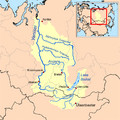
The Yenisey basin, which includes Lake Baikal
-
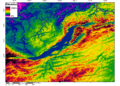
A digital elevation model of Lake Baikal region
-
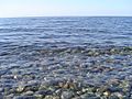
Lake Baikal's water is especially clear
-
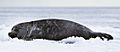
The Baikal seal is endemic to Lake Baikal.
-
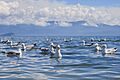
Mongolian gulls on Baikal
-
Two species of grayling (Thymallus baikalensis and T. brevipinnis) are found only in Baikal and rivers that drain into the lake.
-

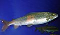
The omul (Coregonus migratorius) is endemic to Lake Baikal, and is a source of income to locals.
-
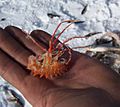
A "giant" Brachyuropus reicherti (Acanthogammaridae) amphipod caught during ice fishing in the lake. Red-orange is its natural, living coloration
-
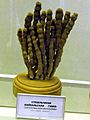
Museum specimen of the branching sponge Lubomirskia baicalensis (living are brighter green)
-
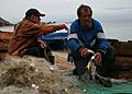
Baikal fishermen fish for 15 commercially used species. The omul, found only in Baikal, accounts for most of the catch.
-

Cracks in Baikal ice
-
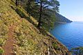
Great Baikal Trail goes from Litvyanka to Bolshoe Goloustnoye along Lake Baikal coast
-
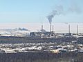
Baykalsk Pulp and Paper Mill in 2008, 5 years before its closure
-
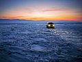
The lake in the winter. The ice is thick enough to support pedestrians and snowmobiles.
-
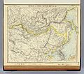
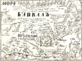
An 1883 British map using the More Baikal (Baikal Sea) designation, rather than the conventional Ozero Baikal (Lake Baikal)
-
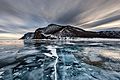
Frozen lake Baikal near Olkhon Island
-
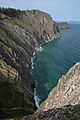
Cliffs on Olkhon Island
-
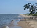
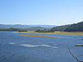
A sandy beach in the Kabansky District
-

Mountains on the Svyatoy Nos Peninsula, Zabaykalsky National Park
-
The river Turka at its mouth before joining Lake Baikal
-
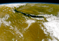
Lake Baikal as seen from the OrbView-2 satellite
-
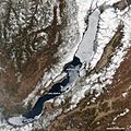
Spring ice melt underway on Lake Baikal, on 4 May: Notice the ice-covered north, while much of the south is already ice-free.
-
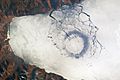
Circle of thin ice, diameter of 4.4 km (2.7 mi) at the lake's southern tip, probably caused by convection
-

Delta of the Selenga River, Baikal's main tributary
-
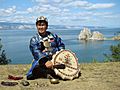
Buryat shaman on Olkhon Island
-
Russian map circa 1700, Baikal (not to scale) is at top
-
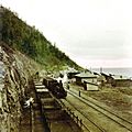
Steam locomotive on the Circum-Baikal Railroad
-
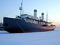
Angara was launched in 1900 and is one of the oldest surviving icebreakers


.jpg)


See also
 In Spanish: Lago Baikal para niños
