
Image: Caspianseamap

Size of this preview: 598 × 600 pixels. Other resolutions: 239 × 240 pixels | 600 × 602 pixels.
Original image (600 × 602 pixels, file size: 199 KB, MIME type: image/png)
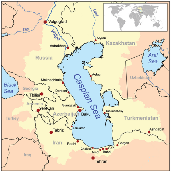
Description: This is a map of the Caspian Sea including a small locator map. The drainage basin of the Caspian Sea is in yellow. The map is based on USGS and Digital Chart of the World data. Note the Aral Sea boundaries are circa 1960, not current boundaries.
Title: Caspianseamap
Credit: No machine-readable source provided. Own work assumed (based on copyright claims).
Author: No machine-readable author provided. Kmusser assumed (based on copyright claims).
Usage Terms: Creative Commons Attribution-Share Alike 2.5
License: CC BY-SA 2.5
License Link: http://creativecommons.org/licenses/by-sa/2.5
Attribution Required?: Yes
Image usage
The following 3 pages link to this image:

All content from Kiddle encyclopedia articles (including the article images and facts) can be freely used under Attribution-ShareAlike license, unless stated otherwise.