
Ledyard, Connecticut facts for kids
Quick facts for kids
Ledyard, Connecticut
|
||
|---|---|---|
|
||

Location in New London County, Connecticut
|
||
| Country | United States | |
| State | Connecticut | |
| County | New London | |
| Metropolitan area | New London | |
| Incorporated | 1836 | |
| Named for | William Ledyard | |
| Government | ||
| • Type | Mayor-council | |
| Area | ||
| • Total | 40.0 sq mi (103.6 km2) | |
| • Land | 38.1 sq mi (98.8 km2) | |
| • Water | 1.9 sq mi (4.8 km2) | |
| Elevation | 295 ft (90 m) | |
| Population
(2020)
|
||
| • Total | 15,413 | |
| • Density | 385.3/sq mi (148.77/km2) | |
| Time zone | UTC−5 (Eastern) | |
| • Summer (DST) | UTC−4 (Eastern) | |
| ZIP Codes |
06335, 06338, 06339
|
|
| Area code(s) | 860 | |
| FIPS code | 09-42600 | |
| GNIS feature ID | 0213450 | |

Ledyard is a Town in New London County, Connecticut, United States, located along the Thames River. The town is named after Colonel William Ledyard, a Revolutionary War officer who was killed at the Battle of Groton Heights. The population was 15,413 at the 2020 census. The Foxwoods Resort Casino, owned and operated by the Mashantucket Pequot Tribe, is located in the northeastern section of Ledyard, on the reservation owned by the tribe.
Ledyard's zip code is 06339. Within the southwestern area of Ledyard is the district known as Gales Ferry, which has the postal code 06335. In the northeast is Mashantucket, with the postal code 06338.
Contents
Geography

According to the United States Census Bureau, the town has a total area of 40.0 square miles (104 km2), of which 38.1 square miles (99 km2) is land and 1.9 square miles (4.9 km2), or 4.62%, is water. Ledyard is situated north of Groton, and borders the east bank of the Thames River in southeastern Connecticut. The northern half of the Naval Submarine Base New London is located in the southwest corner of the town.
Ledyard is among the areas of the United States that was covered by a continental ice sheet during the last Ice Age. Therefore, Ledyard has its share of interesting glacial geology. The glaciers that covered Ledyard carried the many large boulders that litter the town. The town has set aside land designated as a "Glacial Park" which consists of a section of end moraine and outwash deposits (containing kettles). This area encompasses a segment of the "Ledyard Moraine"—a clast-supported boulder deposit that is anomalous in nature.
The principal communities of Ledyard are Ledyard Center (also known as Ledyard Village) and the Gales Ferry section (including Christy Hill Estates, Devonshire Estates, Ferry View Heights, Glenwoods, Birdland, Sherwood Forest, and Woodridge Estates). Other minor communities and geographic areas are Aljen Heights, Barrett Park, Colonial Manor, Cranwood Homestead, Highlands, Lakeside, Lantern Hill, Long Pond, Parsonage Hill Manor, Presidential Estates, Quaker Town, and Stonehenge. The town also contains the Mashantucket Pequot Reservation, in the northeastern corner of the town.
Demographics
| Historical population | |||
|---|---|---|---|
| Census | Pop. | %± | |
| 1840 | 1,871 | — | |
| 1850 | 1,558 | −16.7% | |
| 1860 | 1,615 | 3.7% | |
| 1870 | 1,392 | −13.8% | |
| 1880 | 1,373 | −1.4% | |
| 1890 | 1,183 | −13.8% | |
| 1900 | 1,236 | 4.5% | |
| 1910 | 1,079 | −12.7% | |
| 1920 | 1,161 | 7.6% | |
| 1930 | 1,144 | −1.5% | |
| 1940 | 1,426 | 24.7% | |
| 1950 | 1,749 | 22.7% | |
| 1960 | 5,395 | 208.5% | |
| 1970 | 14,837 | 175.0% | |
| 1980 | 13,735 | −7.4% | |
| 1990 | 14,913 | 8.6% | |
| 2000 | 14,687 | −1.5% | |
| 2010 | 15,051 | 2.5% | |
| 2020 | 15,413 | 2.4% | |
| Population 1840 - 2000 Population 2010 |
|||
As of the census of 2000, there were 14,687 people, 5,286 households, and 4,101 families residing in the town. The population density was 385.1 people per square mile (148.7/km2). There were 5,486 housing units at an average density of 143.8 per square mile (55.5/km2). The racial makeup of the town was:
- 88.23% White
- 3.51% Native American
- 2.70% Hispanic or Latino of any race
- 2.50% African American
- 2.19% Asian
- 0.07% Pacific Islander
- 0.84% from other races
- 2.66% from two or more races
There were 5,286 households, out of which 39.6% had children under the age of 18 living with them, 65.2% were married couples living together, 9.4% had a female householder with no husband present, and 22.4% were non-families. 16.4% of all households were made up of individuals, and 5.1% had someone living alone who was 65 years of age or older. The average household size was 2.78 and the average family size was 3.12.
The ages of Ledyard's population were spread out, with:
- 28.3% under 18
- 6.3% from 18 to 24
- 31.0% from 25 to 44
- 25.4% from 45 to 64
- 9.0% from 65 years of age or older.
The median age was 37 years. For every 100 females, there were 97.4 males. For every 100 females age 18 and over, there were 96.6 males.
The median income for a household in the town was $62,647, and the median income for a family was $69,214. Males had a median income of $46,582 versus $32,339 for females. The per capita income for the town was $24,953. About 2.9% of families and 4.0% of the population were below the poverty line, including 4.5% of those under age 18 and 2.7% of those age 65 or over.
| Voter Registration and Party Enrollment as of October 25, 2005 | |||||
|---|---|---|---|---|---|
| Party | Active Voters | Inactive Voters | Total Voters | Percentage | |
| Republican | 2,350 | 104 | 2,454 | 27.07% | |
| Democratic | 1,879 | 85 | 1,964 | 21.66% | |
| Unaffiliated | 4,404 | 245 | 4,649 | 51.27% | |
| Minor Parties | 0 | 0 | 0 | 0.0% | |
| Total | 8,633 | 434 | 9,067 | 100% | |
Points of interest
- Allyn's Point on the Thames River
National Register of Historic Places
- Applewood Farm—founded in 1826, it was listed on the NRHP in 1987.
- Gurdon Bill Store—built in 1818, it was added to the NRHP in 1982.
- Nathan Lester House—built in 1793, it was listed on the National Register of Historic Places in 1972.
- Main Sawmill—built in 1869, it was added to the NRHP in 1972.
- Mashantucket Pequot Reservation Archeological District—added to the NRHP and declared a U.S. National Historic Landmark in 1993.
- Perkins-Bill House—built in 1781, it was listed on the National Register of Historic Places in 2000.
- Capt. Mark Stoddard Farmstead—built in 1770, it was listed on the National Register of Historic Places in 1992.

Notable people
- Frederick Ayer (1822–1918), industrialist born in Ledyard
- Dennis Blair (1947-), Admiral, USN retired; Director National Intelligence Agency; lived in Ledyard.
- Andy Dick (1965–), actor/comedian, grew up in Ledyard
- Doc Hammer (1967–), painter and co-creator of The Venture Bros., born in Ledyard
- Richard Arthur Hayward (1947-), Chairman of the Mashantucket Pequot Tribe for twenty-three years, worked in Ledyard.
- Ron Jirsa (1959–), men's college basketball coach born in Ledyard
- Casey Neistat (1981–), filmmaker, grew up in Ledyard
- Jackalyne Pfannenstiel (1947-2017), US Assistant Secretary of the Navy, grew up in Ledyard.
- Fuller Potter (1910–1990), abstract expressionist artist, lived most of his life in town
- Samuel Seabury (1729–1796), Second Presiding Bishop of the Protestant Episcopal Church, born in Ledyard
- Gordon Waller (1945-2009), member of Peter & Gordon, lived in Ledyard
- Lyn-Z (1977–), bassist for Mindless Self Indulgence, grew up in Ledyard
Images for kids
-
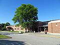
Ledyard High School in 2014

See also
 In Spanish: Ledyard (Connecticut) para niños
