
List of Indiana state historical markers in Marion County facts for kids

This is a list, as of November 2023[update], of the Indiana state historical markers in Marion County.
This is intended to be a complete list of the official state historical markers placed in Marion County, Indiana, United States by the Indiana Historical Bureau. The locations of the historical markers and their latitude and longitude coordinates are included below when available, along with their names, years of placement, and topics as recorded by the Historical Bureau. There are 109 historical markers located in Marion County.
Historical markers
| Marker title | Image | Year placed | Location | City | Topics |
|---|---|---|---|---|---|
| State Capitol |  |
1946 | East entrance to the Statehouse at N. Capitol Avenue and W. Market Street 39°46′7″N 86°9′43″W / 39.76861°N 86.16194°W |
Indianapolis | Buildings and Architecture, Government Institutions, Politics |
| Anthony Wayne 1745–1796 |  |
1960 | Front lawn of George Washington High School at 2215 W. Washington Street 39°45′57″N 86°11′59″W / 39.76583°N 86.19972°W |
Indianapolis | Military, Early Settlement and Exploration |
| Sarah T. Bolton |  |
1960 | 107 E. Sherman Drive, west of Sarah T. Bolton Park 39°43′8″N 86°6′5.6″W / 39.71889°N 86.101556°W |
Beech Grove | Arts and Culture, Women |
| Lincoln to the Citizens of Indiana | 1961 | 402 W. Washington Street at Missouri Street 39°46′2.6″N 86°9′55.4″W / 39.767389°N 86.165389°W |
Indianapolis | Politics, Military | |
| Toll House - Michigan Road |  |
1961 | 4702 N. Michigan Road/U.S. Route 421 39°50′29.4″N 86°11′20.4″W / 39.841500°N 86.189000°W |
Indianapolis | Transportation, Business, Industry, and Labor |
| Camp Morton 1861–1865 |  |
1962 | 1900 block of N. Alabama Street at the Herron-Morton Place Historic Park 39°47′35″N 86°9′8″W / 39.79306°N 86.15222°W |
Indianapolis | Military |
| Brig. General Benjamin Harrison 1833–1901 |  |
1963 | President Benjamin Harrison Home at 1230 N. Delaware Street 39°47′3″N 86°9′15″W / 39.78417°N 86.15417°W |
Indianapolis | Politics, Military |
| Civil War Arsenal 1861–1864 |  |
1964 | East entrance to the Statehouse at N. Capitol Avenue and W. Market Street 39°46′7.5″N 86°9′42.2″W / 39.768750°N 86.161722°W |
Indianapolis | Military |
| Home of Charles Warren Fairbanks House May 11, 1852 – June 4, 1918 | 1966 | In the front lawn of a gated establishment at 30th and Meridian Streets 39°48′35″N 86°9′25″W / 39.80972°N 86.15694°W |
Indianapolis | Politics | |
| The Central Canal |  |
1966 | Intersection of Illinois Street and Westfield Boulevard 39°51′18″N 86°9′36″W / 39.85500°N 86.16000°W |
Indianapolis | Transportation, Business, Industry, and Labor |
| Milestones in Nursing | 1968 | 1001 W. 10th Street at the Nursing Museum entrance at Eskanazi Hospital 39°46′48.3″N 86°10′33″W / 39.780083°N 86.17583°W |
Indianapolis | Women, Science, Medicine, and Inventions | |
| Mary Bryan, Pioneer Woman | 1975 | Cemetery at Pine Street and Southport Road 39°39′54.5″N 86°6′59″W / 39.665139°N 86.11639°W |
Southport | Women, Early Settlement and Exploration | |
| Indianapolis Motor Speedway | 1975 | 4790 W. 16th Street at the Indianapolis Motor Speedway Museum 39°47′23″N 86°14′1″W / 39.78972°N 86.23361°W |
Indianapolis | Sports, Special Events, Science, Medicine, and Inventions | |
| Former U.S. Arsenal |  |
1976 | Western edge of the Arsenal Technical High School campus 39°46′30″N 86°7′59″W / 39.77500°N 86.13306°W |
Indianapolis | Military |
| Crown Hill |  |
1976 | 738 W. 38th Street in Crown Hill Cemetery, along the road between the chapel/crypt and the 38th Street overpass 39°49′32″N 86°10′22.6″W / 39.82556°N 86.172944°W |
Indianapolis | Cemetery |
| Woodruff Place |  |
1976 | On the median south of the fountain at Woodruff Cross Drive and Woodruff Middle Drive 39°46′39″N 86°7′42.4″W / 39.77750°N 86.128444°W |
Indianapolis | Historic District, Neighborhoods, and Towns, Buildings and Architecture |
| The Indianapolis Times
(Marker no longer standing) |
1979 | 300 block of W. Maryland Street at Capitol Avenue 39°45′57″N 86°9′44″W / 39.76583°N 86.16222°W |
Indianapolis | Newspapers and Media | |
| First Presbyterian Church of Southport | 1983 | 6200 McFarland Road at Banta Road 39°40′23″N 86°6′40″W / 39.67306°N 86.11111°W |
Southport | Religion | |
| William Forsyth 1854–1935 | 1984 | Brown's Corner Park at N. Emerson Avenue and E. Washington Street 39°46′13″N 86°5′3″W / 39.77028°N 86.08417°W |
Indianapolis | Arts and Culture | |
| Macedonian Tribune | 1990 | Southeastern corner of West and Washington streets 39°46′1.4″N 86°10′0.4″W / 39.767056°N 86.166778°W |
Indianapolis | Newspapers and Media, Immigration and Ethnic Groups | |
| North Meridian Street Historic District |  |
1991 | Westfield Boulevard and N. Meridian Street 39°51′28″N 86°9′26.5″W / 39.85778°N 86.157361°W |
Indianapolis | Historic District, Neighborhoods, and Towns |
| North Meridian Street Historic District |  |
1991 | 40th Street and N. Meridian Street 39°49′45″N 86°9′24.6″W / 39.82917°N 86.156833°W |
Indianapolis | Historic District, Neighborhoods, and Towns |
| Crispus Attucks High School |  |
1992 | 1140 Dr. Martin Luther King, Jr. Street 39°46′58″N 86°10′7″W / 39.78278°N 86.16861°W |
Indianapolis | African American, Education, Buildings and Architecture |
| North Western Christian University |  |
1992 | 1325 N. College Avenue, on the eastern side of the street north of the Interstate 65 overpass 39°47′5.6″N 86°8′40.4″W / 39.784889°N 86.144556°W |
Indianapolis | Education, Religion |
| Site of Golden Hill Totem Pole | 1992 | Totem Lane in the Golden Hill neighborhood 39°49′6″N 86°11′6″W / 39.81833°N 86.18500°W |
Indianapolis | Arts and Culture, American Indian/Native American | |
| Site of the Central Canal |  |
1992 | At the Central Canal, behind the North State Office Building at 100 N. Senate Avenue 39°46′10″N 86°9′56″W / 39.76944°N 86.16556°W |
Indianapolis | Transportation, Business, Industry, and Labor |
| Ransom Place Historic District |  |
1993 | 830 Dr. Martin Luther King, Jr. Street 39°46′50″N 86°10′6″W / 39.78056°N 86.16833°W |
Indianapolis | Historic District, Neighborhoods, and Towns, African American |
| Willard Park | 1993 | Willard Park at 1901 E. Washington Street 39°46′2″N 86°7′42″W / 39.76722°N 86.12833°W |
Indianapolis | Education | |
| Indiana School for the Blind | 1994 | Northern side of the entrance for 7725 N. College Avenue 39°53′41″N 86°8′39″W / 39.89472°N 86.14417°W |
Indianapolis | Education, Government Institutions | |
| Indiana Avenue |  |
1994 | On a traffic island at the southeastern corner of West Street and Indiana Avenue 39°46′31″N 86°9′59.32″W / 39.77528°N 86.1664778°W |
Indianapolis | African American, Historic District, Neighborhoods, and Towns |
| Bulgarian Orthodox Church | 1995 | On the campus of Indiana University – Purdue University Indianapolis at 226 N. Blackford Street 39°46′16.6″N 86°10′13″W / 39.771278°N 86.17028°W |
Indianapolis | Religion, Immigration and Ethnic Groups | |
| Joseph W. Summers Memorial Bridge |  |
1995 | Eastern side of Meridian Street on the southeastern corner of its bridge over Fall Creek 39°48′11″N 86°9′23.4″W / 39.80306°N 86.156500°W |
Indianapolis | Transportation, Buildings and Architecture, Politics |
| Joseph W. Summers Memorial Bridge |  |
1995 | Western side of Meridian Street on the northwestern corner of its bridge over Fall Creek 39°48′13″N 86°9′24.3″W / 39.80361°N 86.156750°W |
Indianapolis | Transportation, Buildings and Architecture |
| The Old Northside |  |
1995 | 1456 Central Avenue 39°47′13″N 86°8′58.4″W / 39.78694°N 86.149556°W |
Indianapolis | Historic District, Neighborhoods, and Towns, Buildings and Architecture |
| The Old Northside |  |
1995 | 12th and Delaware Streets 39°46′59″N 86°9′15″W / 39.78306°N 86.15417°W |
Indianapolis | Historic District, Neighborhoods, and Towns, Buildings and Architecture |
| Fort Benjamin Harrison |  |
1996 | Otis Avenue between Hess and Lawton Roads 39°51′26″N 86°0′57.2″W / 39.85722°N 86.015889°W |
Indianapolis | Military, Historic District, Neighborhoods, and Towns |
| Bates-Hendricks House |  |
1996 | 1526 S. New Jersey Street along the median north of Lincoln Street 39°44′46.5″N 86°9′2″W / 39.746250°N 86.15056°W |
Indianapolis | Buildings and Architecture, Politics |
| Indiana Federation of Colored Women's Clubs |  |
1997 | 2034 N. Capitol Avenue 39°47′38.6″N 86°9′42″W / 39.794056°N 86.16167°W |
Indianapolis | African American, Women |
| Romanian Orthodox Church | 1998 | White River State Park at the northeastern corner of the Blackford Street bridge over the Central Canal 39°46′10″N 86°10′12″W / 39.76944°N 86.17000°W |
Indianapolis | Immigration and Ethnic Groups, Religion | |
| Lockerbie Square |  |
1998 | Lockerbie Street and N. East Street 39°46′19.4″N 86°8′55.4″W / 39.772056°N 86.148722°W |
Indianapolis | Historic District, Neighborhoods, and Towns, Buildings and Architecture |
| German Greenhouses and Truck Gardens | 1998 | Bluff Park, at Bluff Road and Hanna Avenue 39°42′26″N 86°10′12″W / 39.70722°N 86.17000°W |
Indianapolis | Immigration and Ethnic Groups, Nature and Natural Disasters, Business, Industry, and Labor, Agriculture | |
| Indianapolis Fire Department / Bowen-Merrill Fire | 1999 | 2 W. Washington Street 39°46′2″N 86°9′31.5″W / 39.76722°N 86.158750°W |
Indianapolis | Government Institutions, Nature and Natural Disasters | |
| Athenaeum |  |
1999 | 401 E. Michigan Street 39°46′25″N 86°9′0″W / 39.77361°N 86.15000°W |
Indianapolis | Immigration and Ethnic Groups, Buildings and Architecture |
| Market Street Temple | 1999 | 435 E. Market Street 39°46′5.6″N 86°8′59″W / 39.768222°N 86.14972°W |
Indianapolis | Religion, Immigration and Ethnic Groups | |
| Holy Rosary–Danish Church Historic District |  |
2000 | Southeastern corner of S. East Street and S. Stevens Street 39°45′28″N 86°8′57.4″W / 39.75778°N 86.149278°W |
Indianapolis | Immigration and Ethnic Groups, Historic District, Neighborhoods, and Towns |
| Widows and Orphans Friends' Society | 2003 | Eastern side of Capitol Avenue, ½ block south of 14th Street 39°47′8.4″N 86°9′40″W / 39.785667°N 86.16111°W |
Indianapolis | Women | |
| Greek Orthodox Church |  |
2003 | West Street beside the Indiana Historical Society at 450 W. Ohio Street 39°46′14″N 86°10′0″W / 39.77056°N 86.16667°W |
Indianapolis | Religion, Immigration and Ethnic Groups |
| Brookville Road |  |
2004 | 10622 Brookville Road 39°44′22.4″N 85°58′41″W / 39.739556°N 85.97806°W |
Indianapolis | Transportation, Business, Industry, and Labor |
| John Muir in Indianapolis |  |
2004 | On a grassy triangle at the former site of Osgood, Smith & Co. near the junction of Illinois and Merrill Streets 39°45′31.5″N 86°9′36.6″W / 39.758750°N 86.160167°W |
Indianapolis | Nature and Natural Disasters, Politics |
| Marion County Girl Scouts | 2004 | Irvington Presbyterian Church at 55 Johnson Avenue 39°46′9″N 86°4′19″W / 39.76917°N 86.07194°W |
Indianapolis | Women, Arts and Culture | |
| Zerelda G. Wallace |  |
2004 | Central Christian Church at 701 N. Delaware Street 39°46′37″N 86°9′13″W / 39.77694°N 86.15361°W |
Indianapolis | Women, Religion |
| 28th Regiment USCT | 2004 | Virginia Avenue and McCarty Street 39°45′26″N 86°8′42″W / 39.75722°N 86.14500°W |
Indianapolis | African American, Military | |
| Robert F. Kennedy on Death of Martin L. King |  |
2005 | King Park at 17th Street and Broadway Street 39°47′25.4″N 86°8′45.6″W / 39.790389°N 86.146000°W |
Indianapolis | Politics, African American |
| Calvin Fletcher | 2006 | Virginia Avenue and East Street 39°45′39″N 86°8′57″W / 39.76083°N 86.14917°W |
Indianapolis | Historic District, Neighborhoods, and Towns, African American, Military | |
| John Freeman | 2006 | Next to the Landmark Center, on the western side of Pennsylvania Street between 10th and 11th Streets 39°41′54″N 86°9′21″W / 39.69833°N 86.15583°W |
Indianapolis | Underground Railroad, African American, Government Institutions | |
| 1907 Indiana Eugenics Law | 2007 | Eastern lawn of the Indiana State Library at 140 N. Senate Avenue 39°46′11″N 86°9′49″W / 39.76972°N 86.16361°W |
Indianapolis | Science, Medicine, and Inventions, Legal | |
| Ovid Butler, Sr. |  |
2007 | 1306 North Park Avenue 39°47′4″N 86°8′52″W / 39.78444°N 86.14778°W |
Indianapolis | Education, Newspapers and Media |
| St. Vincent's Infirmary |  |
2007 | 536 E. Vermont Street 39°46′22.6″N 86°8′52″W / 39.772944°N 86.14778°W |
Indianapolis | Medicine |
| The Lincoln Funeral Train |  |
2009 | Southern lawn of the Indiana Statehouse at 200 W. Washington Street 39°46′3″N 86°9′46″W / 39.76750°N 86.16278°W |
Indianapolis | Government Institutions, Politics, Special Events |
| Bethel African Methodist Episcopal Church |  |
2009 | 414 W. Vermont Street 39°46′23″N 86°9′57″W / 39.77306°N 86.16583°W |
Indianapolis | African American, Buildings & Architecture, Education & Libraries, Military, Religion, Underground Railroad |
| Major Taylor | _(2).jpg) |
2009 | 38th Street at the Monon Trail, across from the Indiana State Fairgrounds 39°49′31″N 86°8′23″W / 39.82528°N 86.13972°W |
Indianapolis | African American, Sports |
| Indianapolis Propylaeum |  |
2009 | In front of the Propylaeum at 1410 N. Delaware Street 39°47′11″N 86°9′16″W / 39.78639°N 86.15444°W |
Indianapolis | Women, Buildings & Architecture, Arts & Culture |
| Isaac Blackford |  |
2011 | Northeast corner of Blackford Street and New York Street 39°46′18″N 86°10′12″W / 39.77167°N 86.17000°W |
Indianapolis | |
| Washington Park Baseball | 2011 | 1200 W. Washington Street 39°45′58″N 86°10′55″W / 39.76611°N 86.18194°W |
Indianapolis | ||
| St. Vincent's Hospital | 2013 | Illinois-Fall Creek Center, 2535 N. Capitol Avenue 39°48′12″N 86°9′36″W / 39.80333°N 86.16000°W |
Indianapolis | ||
| Indianapolis Times | 2013 | Green space east of the Westin Indianapolis Hotel, between Maryland Street and Washington Street 39°45′58″N 86°9′46″W / 39.76611°N 86.16278°W |
Indianapolis | ||
| Allison Machine Shop | 2015 | 1200 W. Main Street 39°47′0″N 86°14′28″W / 39.78333°N 86.24111°W |
Speedway | Business, Industry, & Labor; Military | |
| T. C. Steele Studio and Herron | 2015 | 110 E 16th Street 39°47′19″N 86°9′19″W / 39.78861°N 86.15528°W |
Indianapolis | ||
| James Overall | 2016 | Near 524 N. West Street between Indiana Avenue and Michigan Street 39°46′31″N 86°10′1″W / 39.77528°N 86.16694°W |
Indianapolis | African American, Underground Railroad, Law & Court Case, Religion | |
| Senate Avenue YMCA | 2016 | 420 N. Senate Ave., at the southwest corner of Michigan Street and Senate Avenue 39°46′27″N 86°9′48″W / 39.77417°N 86.16333°W |
Indianapolis | African American, Education, Buildings & Architecture | |
| Central State Hospital |  |
2016 | Central State Mansion at 202 Steeples Boulevard 39°46′3″N 86°12′41″W / 39.76750°N 86.21139°W |
Indianapolis | Science, Medicine, Invention, Education |
| Little Sisters of the Poor | 2017 | 520 E. Vermont Street 39°46′23″N 86°8′54″W / 39.77306°N 86.14833°W |
Indianapolis | Women, Religion | |
| German Newspapers' Demise | 2017 | 41 S. Delaware Street (immediately south of the Julia M. Carson Transit Center at 201 E. Washington Street) 39°45′58″N 86°9′16″W / 39.76611°N 86.15444°W |
Indianapolis | ||
| "Cannon Ball" Baker |  |
2017 | 902 E Garfield Drive 39°44′1″N 86°8′40″W / 39.73361°N 86.14444°W |
Indianapolis | |
| First Lady Caroline Harrison |  |
2017 | Benjamin Harrison Presidential Site, 1230 N. Delaware Street 39°47′2″N 86°9′15″W / 39.78389°N 86.15417°W |
Indianapolis | Women, Politics, Arts and Culture |
| James Whitcomb Riley Home | |
2018 | 528 Lockerbie Street 39°46′19″N 86°8′52″W / 39.77194°N 86.14778°W |
Indianapolis | Arts and Culture; Buildings & Architecture |
| WWI Aviation Repair Depot | 2018 | 1182 N. Main Street, near Gilman Street 39°46′59″N 86°14′28″W / 39.78306°N 86.24111°W |
Speedway | Business, Industry, & Labor; Military; Science, Medicine, & Invention; Transportation | |
| Lincoln Hospital, 1909–ca. 1915 | 2018 | 1109 N. Senate Avenue 39°46′56″N 86°9′46″W / 39.78222°N 86.16278°W |
Indianapolis | ||
| Romanian Orthodox Church (Indianapolis) | 2019 | White River State Park at the northeast corner of the Central Canal and N. Blackford Street bridge 39°46′9″N 86°10′12″W / 39.76917°N 86.17000°W |
Indianapolis | Religion, Immigration and Ethnic Group | |
| May Wright Sewall (1844–1920) |  |
2019 | Northwest corner of Veterans Memorial Plaza at the corner of Meridian Street and North Street 39°46′31″N 86°9′25″W / 39.77528°N 86.15694°W |
Indianapolis | |
| Lt. Col. Joseph H. Ward, M.D, 1872–1952 | 2019 | West 21st Street and North Boulevard Place 39°47′42″N 86°9′47″W / 39.79500°N 86.16306°W |
Indianapolis | ||
| Pathological Department / Old Pathology Building |  |
2019 | 3045 W. Vermont Street 39°46′11″N 86°12′47″W / 39.76972°N 86.21306°W |
Indianapolis | Science, Medicine, and Technology |
| Willard Park | 2019 | 1901 E. Washington Street 39°46′2″N 86°7′44″W / 39.76722°N 86.12889°W |
Indianapolis | ||
| The American Legion | 2020 | 777 N. Meridian Street 39°46′38″N 86°9′27″W / 39.77722°N 86.15750°W |
Indianapolis | Military | |
| Grace Julian Clarke 1865–1938 | 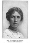 |
2020 | 115 S. Audubon Road 39°46′7″N 86°4′12″W / 39.76861°N 86.07000°W |
Indianapolis | Women, Politics |
| Greek Orthodox Church 1865–1938 | 2020 | West Street beside the Indiana Historical Society, 450 W. Ohio Street 39°46′16″N 86°10′0″W / 39.77111°N 86.16667°W |
Indianapolis | Religion, Immigration and Ethnic Group | |
| Meredith Nicholson 1866–1947 |  |
2020 | 1500 N. Delaware Street 39°47′14″N 86°9′14″W / 39.78722°N 86.15389°W |
Indianapolis | |
| Booth Tarkington 1866–1947 |  |
2019 (Dedicated in 2020) | 4270 N. Meridian Street 39°49′58″N 86°9′25″W / 39.83278°N 86.15694°W |
Indianapolis | Literature, Arts & Culture |
| Rep. Roberta West Nicholson, 1903–1987 |  |
2021 | English Foundation Building at 615 N. Alabama Street 39°46′32″N 86°9′7″W / 39.77556°N 86.15194°W |
Indianapolis | Political, Women |
| Newby Oval | 2021 | Fall Creek Trail, just east of 31st Street 39°48′43″N 86°8′36″W / 39.81194°N 86.14333°W |
Indianapolis | Sports | |
| Harriette Bailey Conn | 2021 | 1 North Capitol Ave 39°46′2″N 86°9′41″W / 39.76722°N 86.16139°W |
Indianapolis | African American, Women, Politics | |
| Origins of Indiana Pride - Indiana LGBTQ Pride | .jpg) |
2021 | 40 Monument Circle 39°46′5″N 86°9′31″W / 39.76806°N 86.15861°W |
Indianapolis | |
| Leedy Manufacturing Company | 2021 | 1601 South Barth Avenue 39°49′46″N 86°8′27″W / 39.82944°N 86.14083°W |
Indianapolis | Business, Industry, and Labor; Arts and Culture; Invention | |
| Indiana Woman's Suffrage | 2021 | 200 West Washington Street 39°46′6″N 86°9′42″W / 39.76833°N 86.16167°W |
Indianapolis | Political; Women | |
| Dr. Amelia Keller, 1871–1943 | 2022 | 988 W. Walnut Street 39°46′38″N 86°10′34″W / 39.77722°N 86.17611°W |
Indianapolis | Science, Medicine, & Invention; Women; Political | |
| John Hope School No. 26 | 2022 | 1301 E. 16th Street 39°47′18″N 86°8′11″W / 39.78833°N 86.13639°W |
Indianapolis | Education & Library; African American | |
| Sigma Gamma Rho | 2022 | 5350 E. University Avenue 39°4′56″N 86°4′34″W / 39.08222°N 86.07611°W |
Indianapolis | African American, Education | |
| Hook's Drug Stores | 2022 | 1101 S. East Street 39°45′7″N 86°8′58″W / 39.75194°N 86.14944°W |
Indianapolis | Science, Medicine & Invention, Business; Business & Industry; African American; Historic District/Town | |
| Felrath Hines, Jr. | 2023 | 1140 Dr. MLK Jr Street 39°46′58″N 86°10′6″W / 39.78278°N 86.16833°W |
Indianapolis | Arts & Culture; African American | |
| Janet Flanner | .jpg) |
2023 | 4061 N. Illinois Street 39°49′48″N 86°9′31″W / 39.83000°N 86.15861°W |
Indianapolis | Newspaper & Media; Women; Arts & Culture |
| Andrew "Bo" Foster | 2023 | 2160 N. Illinois Street 39°47′47″N 86°9′33″W / 39.79639°N 86.15917°W |
Indianapolis | Business, Industry, & Labor; African American | |
| Hinkle Fieldhouse |  |
2023 | 510 W 49th Street 39°50′33″N 86°10′4″W / 39.84250°N 86.16778°W |
Indianapolis | Sports; Buildings & Architecture; Education & Library |
| Lynching of John Tucker |  |
2023 | 110 W Washington Street 39°46′1″N 86°9′36″W / 39.76694°N 86.16000°W |
Indianapolis | African American; Law & Court |
| The Syrian Quarter | 2023 | 500 S. Capitol Avenue 39°45′25″N 86°9′43″W / 39.75694°N 86.16194°W |
Indianapolis | Immigration & Ethnic Group; Arts & Culture | |
| South Side Turnverein |  |
2023 | 306 Prospect Street 39°45′9″N 86°9′11″W / 39.75250°N 86.15306°W |
Indianapolis | Sports; Buildings & Architecture; Immigration & Ethnic Group |
| John Leslie “Wes” Montgomery, 1923-1968 | .jpg) |
2023 | Northwest corner of 10th St. and Bellafontaine St. | Indianapolis | Arts & Culture; African American |
See also
- List of Indiana state historical markers
- National Register of Historic Places listings in Marion County, Indiana

All content from Kiddle encyclopedia articles (including the article images and facts) can be freely used under Attribution-ShareAlike license, unless stated otherwise. Cite this article:
List of Indiana state historical markers in Marion County Facts for Kids. Kiddle Encyclopedia.