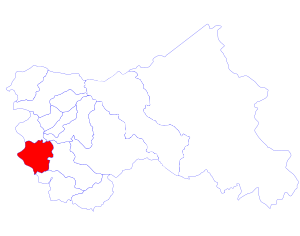
Rajouri District facts for kids

Rajouri is a district located in Jammu and Kashmir. It is known for its beautiful landscapes and diverse communities. This area is close to the Line of Control, which is a border between different parts of Kashmir.
Rajouri is home to many villages where people from the Gujjar and Bakerwal communities live. These communities are especially found near the Pir Panjal mountain range. The district is also famous for its local cheese and other milk products. A popular local dish is "makki di roti," which is a type of bread made from maize. Many people in Rajouri are farmers who grow food for their families.
Contents
Exploring Rajouri District
Rajouri District has several important towns and areas. These are called Tehsils and Blocks. Each of these places has its own unique character and people.
Towns and Areas in Rajouri
The district is divided into 7 Tehsils (towns) and 7 Blocks. These divisions help manage the different parts of the district.
Rajouri's Tehsils
Here are the main Tehsils in Rajouri District:
- Darhal Tehsil
- Budhal Tehsil
- Kalakote Tehsil
- Nowshera Tehsil
- Rajouri Tehsil
- Sunderbani Tehsil
- Thanamandi Tehsil
Rajouri's Blocks
The Blocks in Rajouri District include:
- Rajouri
- Manjakote
- Darhal
- Budhal
- Kalakote
- Sunderbani
- Nowshera
People and Culture in Rajouri
The people living in Rajouri District come from different backgrounds and practice various religions. Some areas have more Hindu residents, while others have more Muslim residents. In 1981, official numbers showed that about 58% of the population was Muslim, 39% Hindu, 2% Sikh, and 1% Buddhist. The district is a great example of different communities living together.
See also
 In Spanish: Distrito de Rajouri para niños

