Howard's Covered Bridge facts for kids
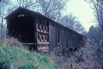
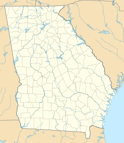
Howard's Covered Bridge is a very old and special bridge. It is located near Smithsonia, Georgia, in Oglethorpe County, Georgia. This bridge is called "covered" because it has a roof and walls. This design helps protect the wooden parts of the bridge from weather like rain and sun.
The bridge is so important that it was added to the National Register of Historic Places on July 1, 1975. This list includes buildings and places that are important to American history.
Contents
About Howard's Covered Bridge
Howard's Covered Bridge is 168 feet (51 meters) long. It stretches over Big Clouds Creek. The bridge was built in 1905. It uses a special building style called a Town lattice design.
Building the Bridge in 1905
Building bridges a long time ago was different from today. Howard's Covered Bridge was built in 1905. A person named Mr. Hunt supervised the building. The bridge was built using the labor of people who were serving time in prison. This was a common way to build public projects in the past.
The bridge is held together with wooden pegs called "trunnels." These are like big wooden nails. The wood for the bridge came from nearby. It was brought to the site using the Smithsonia and Dunlap Railroad. This railroad connected a large farm to the main Georgia Railroad.
A Special Design: Town Lattice
The Town lattice design is a unique way to build wooden bridges. It was created by a man named Ithiel Town. This design uses many wooden planks that cross each other. They form a strong crisscross pattern. This pattern helps the bridge hold a lot of weight. It also makes the bridge very stable.
Why is it Called Howard's Bridge?
The bridge is named after the Howard family. This family was one of the first to settle in the area. They moved there in the late 1700s. Naming the bridge after them honors their history in the community.
Finding the Bridge Today
You can find Howard's Covered Bridge about 3 miles southeast of Smithonia. It is on a road called SR S2164. A special sign, called a historical marker, is near the bridge. The Georgia Historical Society placed this marker. It tells visitors about the bridge's history.
The historical marker is at the southern end of Chandler Silver Road. This is where it meets Cloud's Creek Road. It is also 1.3 miles west of the Cloud's Creek Baptist Church marker.


