
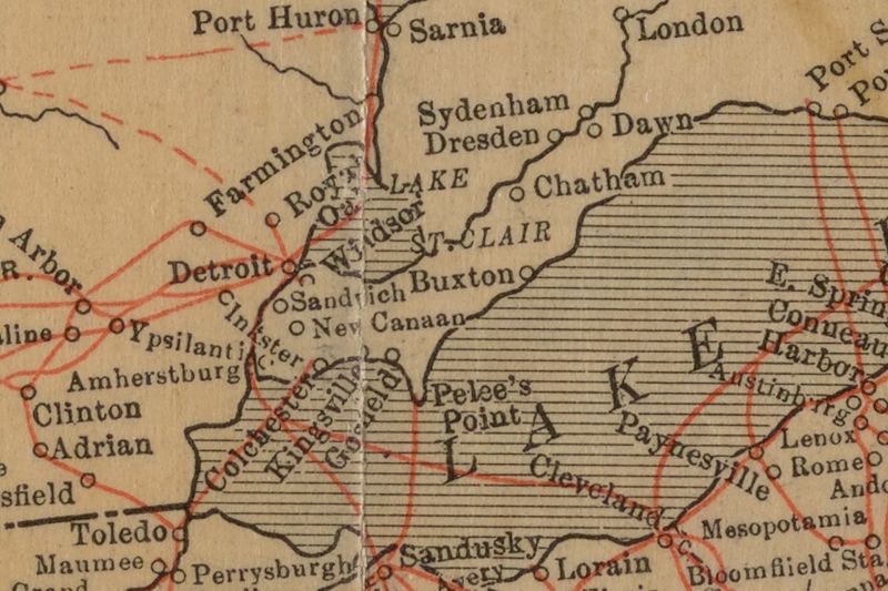
Image: "Underground" routes to Canada, Map cropped to display Southern Ontario, Canada

Size of this preview: 800 × 533 pixels. Other resolutions: 320 × 213 pixels | 864 × 576 pixels.
Original image (864 × 576 pixels, file size: 224 KB, MIME type: image/jpeg)
Description: * Scale ca. 1:12,500,000. Inset: Map showing the lines of the Underground Railroad in Chester and the neighboring Counties of Pennsylvania. Extracted from his The Underground Railroad from slavery to freedom, New York? 1898. Mapping the Nation (NEH grant, 2015-2018)
Title: "Underground" routes to Canada, Map cropped to display Southern Ontario, Canada
Credit: https://digitalcollections.nypl.org/items/d64f0a80-4db6-0133-78eb-00505686d14e
Author: Scan by NYPL
Usage Terms: Public domain
License: Public domain
Attribution Required?: No
Image usage
The following page links to this image:

All content from Kiddle encyclopedia articles (including the article images and facts) can be freely used under Attribution-ShareAlike license, unless stated otherwise.