
Image: "Underground" routes to Canada (NYPL b10341074-5365491) (cropped)
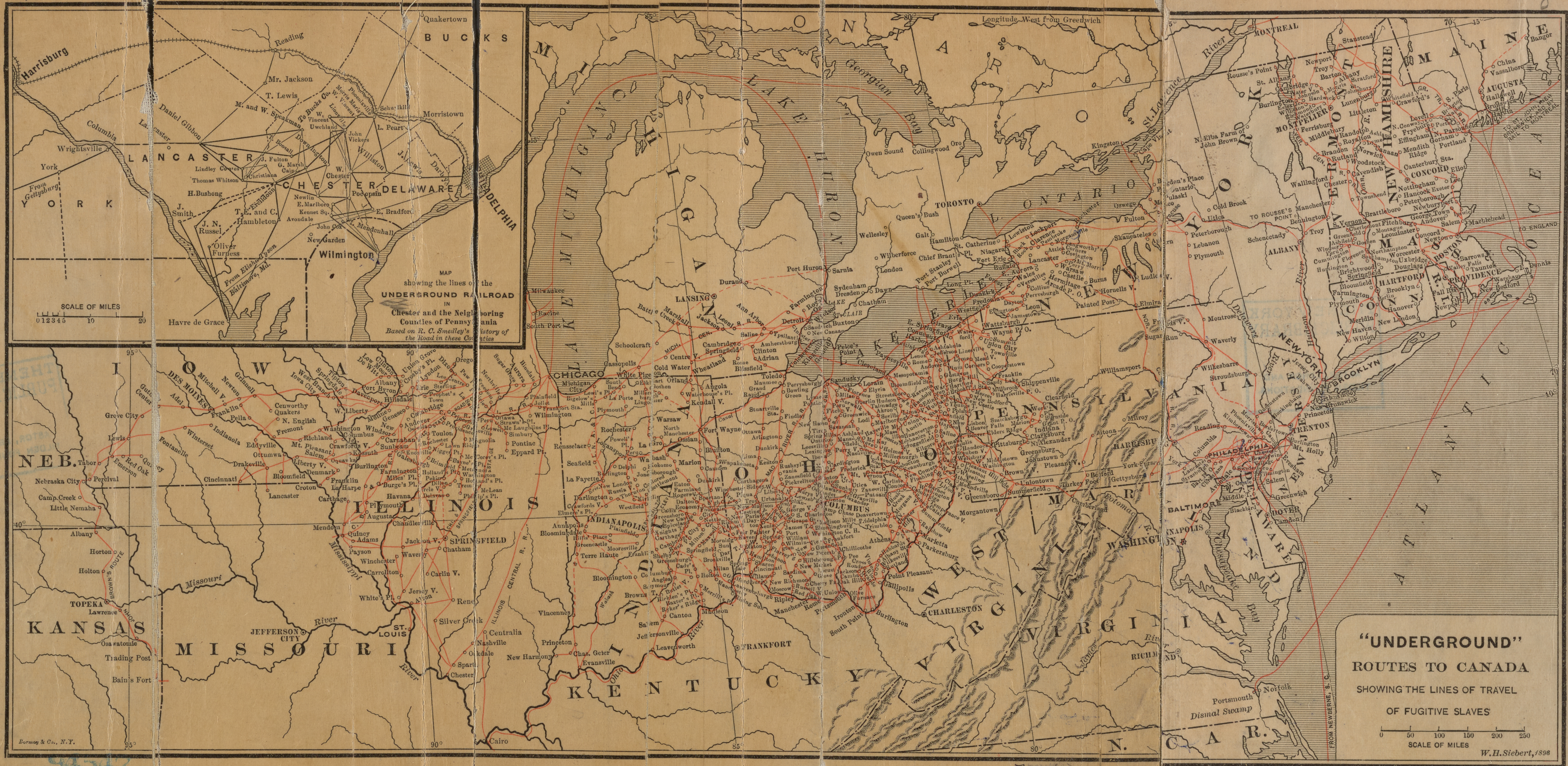
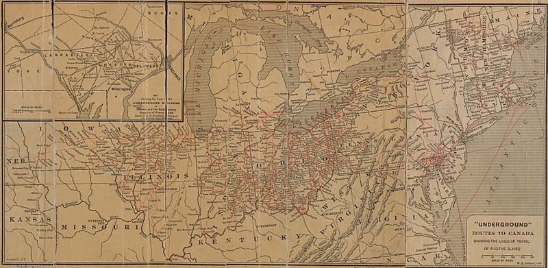
Description: * Scale ca. 1:12,500,000. Inset: Map showing the lines of the Underground Railroad in Chester and the neighboring Counties of Pennsylvania. Extracted from his The Underground Railroad from slavery to freedom, New York? 1898. Mapping the Nation (NEH grant, 2015-2018)
Title: "Underground" routes to Canada (NYPL b10341074-5365491) (cropped)
Credit: https://digitalcollections.nypl.org/items/d64f0a80-4db6-0133-78eb-00505686d14e
Author: Scan by NYPL
Permission: This image is available from the New York Public Library's Digital Library under the digital ID da7163e0-d5a0-0132-9a71-58d385a7bbd0: digitalgallery.nypl.org → digitalcollections.nypl.org
Usage Terms: Public domain
License: Public domain
Attribution Required?: No
Image usage
The following page links to this image:
