
Image: 11496488@N07 2180396721
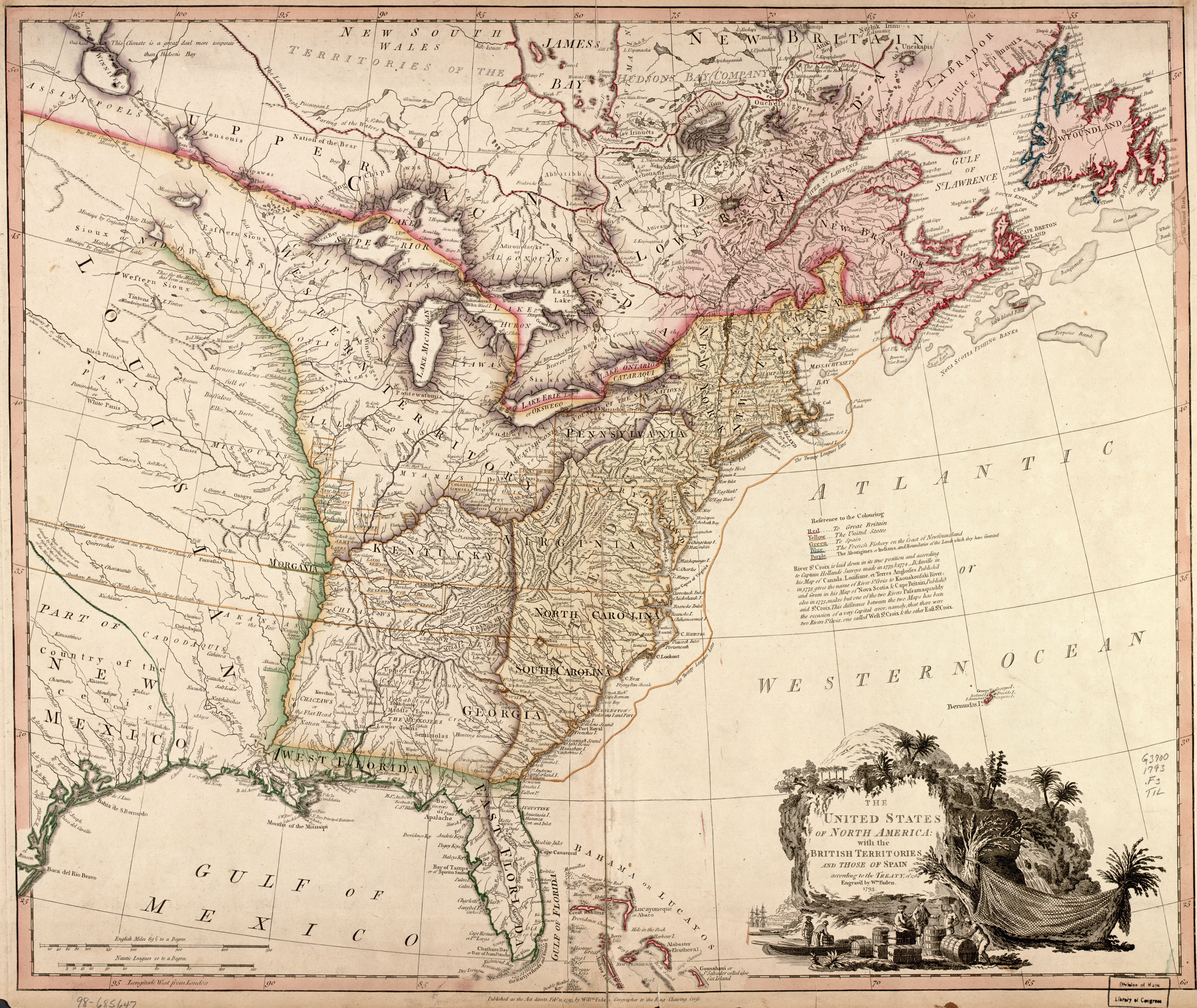
Description: The United Sates of North America (William Faden 1793) Although Aaron Arrowsmith had published several complex maps of North America by 1796, which included the journeys of Hearne, Pond, Mackenzie, Vancouver and many others, numerous prestigious map-making companies were still publishing maps with most of the details of the western regions vestigial remnants nearly a century old. William Faden, the successor of Thomas Jefferys in his cartographic business, published this map which contains the G. De l’Isle version of the Upper Mississippi river, the La Verendrye form of the Border Lakes, and only a modicum of the new configuration of the Albany and Moose river valleys. It will be noted that there exists such relicts as Kik-Kouan river, Monsipi river and the Perray river. But, notwithstanding this, certain new information has been included, notably the postion of the Hudso’s Bay Company’s inland posts in this region. Manitoba does not fare well on this map. (Warkentin and Ruggles. Historical Atlas of Manitoba. map 51, p. 128) The United Sates of North America with the British Territories and those of Span according to the Treaty of 1784, Engrav’d by Wm. Faden 1793 Map drawn by William Faden. Printed in black with coloured portions. Engraved by William Faden. Published in William Faden, General Atlas. London: 1797: No. 46. Image Source: Library of Congress American Memory Project
Title: 11496488@N07 2180396721
Credit: The United Sates of North America (William Faden 1793)
Author: Manitoba Historical Maps
Usage Terms: Creative Commons Attribution 2.0
License: CC BY 2.0
License Link: https://creativecommons.org/licenses/by/2.0
Attribution Required?: Yes
Image usage
The following page links to this image:
