Image: 13colonias

Size of this PNG preview of this SVG file: 411 × 599 pixels. Other resolution: 165 × 240 pixels.
Original image (SVG file, nominally 595 × 867 pixels, file size: 179 KB)
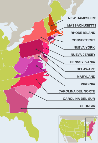
Description: Mapa de las 13 colonias inglesas en América del Norte. Realizado por Educar Chile, un portal de recursos educativos libres sin reserva de copyright sostenido por el Gobierno de Chile.
Title: 13colonias
Credit: File:13colonias.jpg
Author: Original JPEG: Educar Chile SVG edit: PatoBurgues
Usage Terms: Creative Commons Attribution-Share Alike 3.0
License: CC BY-SA 3.0
License Link: http://creativecommons.org/licenses/by-sa/3.0/
Attribution Required?: Yes
Image usage
The following page links to this image:

All content from Kiddle encyclopedia articles (including the article images and facts) can be freely used under Attribution-ShareAlike license, unless stated otherwise.
