
Image: 1670 Augustin Herrman 1621-1686-bohemiensis map
Size of this preview: 763 × 600 pixels. Other resolutions: 305 × 240 pixels | 1,304 × 1,025 pixels.
Original image (1,304 × 1,025 pixels, file size: 274 KB, MIME type: image/jpeg)
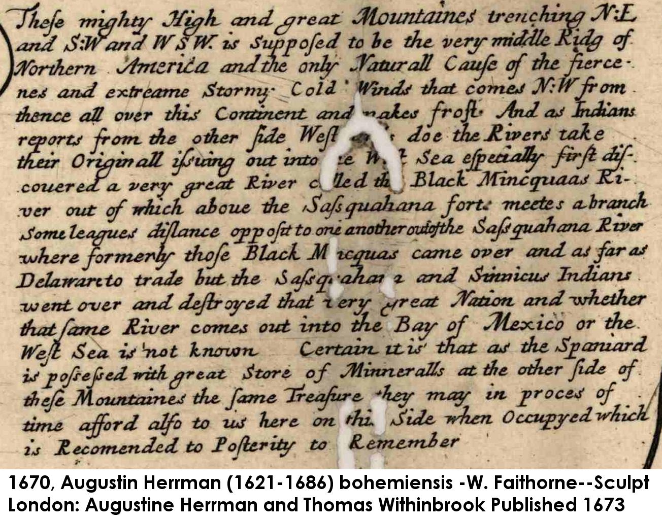
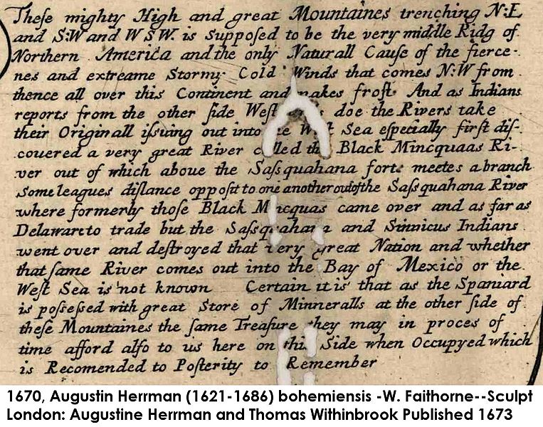
Description: Clip of text from Virginia & Maryland 1670 map. Print located between the headwaters of the Potomac & South Branch rivers on the face of the map.
Title: 1670 Augustin Herrman 1621-1686-bohemiensis map
Credit: USA Library of Congress (Heritage, maps)
Author: Augustin Herrman 1621-1686
Permission: Old Map published in London 1673, public domain
Usage Terms: Public domain
License: Public domain
Attribution Required?: No
Image usage
The following page links to this image:

All content from Kiddle encyclopedia articles (including the article images and facts) can be freely used under Attribution-ShareAlike license, unless stated otherwise.