
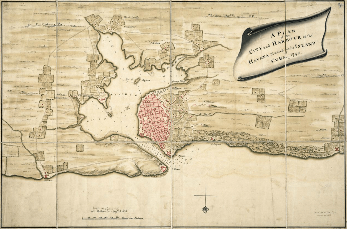
Image: 1740 Plan of the city and harbour of the Havanna situated on the island of Cuba BPL m8628
Size of this preview: 800 × 528 pixels. Other resolutions: 320 × 211 pixels | 1,125 × 743 pixels.
Original image (1,125 × 743 pixels, file size: 598 KB, MIME type: image/png)
Description: A plan of the city and harbour of the Havanna situated on the island of Cuba Date: 1740 Dimensions: 49.0 x 74.0 cm. Scale: Scale not given
Title: 1740 Plan of the city and harbour of the Havanna situated on the island of Cuba BPL m8628
Credit: Boston Public Library, Map Center (Boston, Massachusetts, USA) / http://maps.bpl.org/id/m8628
Author: Author unknown
Usage Terms: Public domain
License: Public domain
Attribution Required?: No
Image usage
The following page links to this image:

All content from Kiddle encyclopedia articles (including the article images and facts) can be freely used under Attribution-ShareAlike license, unless stated otherwise.