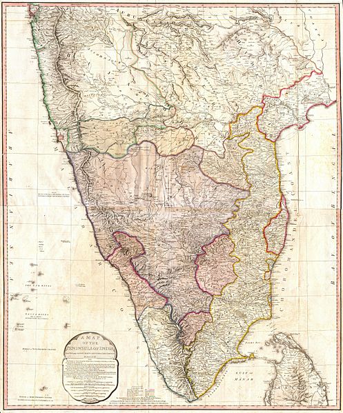
Image: 1793 Faden Wall Map of India - Geographicus - India-faden-1793

Description: This map, created immediately after the Third Anglo-Mysore War (1789-92), shows the division of and territorial loss by the Kingdom of Mysore through the 1792 Treaty of Seringapatam. A "third edition" was created in 1800 showing the territorial changes after the Fourth Anglo-Mysore War (1798–1799). Description from Geographicus: One of the largest and most impressive maps of India to appear in the 18th century. Depicts the subcontinent from Bombay ( Mumbai ) and Aurungabad, south including the northern half of Sri Lanka ( Ceylon ). Printed in 1793 in London by William Faden, “Royal Geographer to the King and to the Prince of Wales”. Includes the routes of various military marches and campaigns including the 1784 March of British Prisoners from Condapoor to Madras, the march of the Marquis of Cornwallis, the march of General Medows, and the march of General Abercromby. Also shows the acquisitions of the British through the Partition Treaty of 1792. The whole is masterfully presented in visually stunning almost three dimensional detail and stunning period color. A must for any serious collection of south Asia maps. Compiled chiefly from papers communicated by the late Sir Archd. Campbell, the surveys of Col. Kelly, Capt. Pringle, Capt. Allan, etc.
Title: A Map of the Peninsula of India.
Credit: This file was provided to Wikimedia Commons by Geographicus Rare Antique Maps, a specialist dealer in rare maps and other cartography of the 15th, 16th, 17th, 18th and 19th centuries, as part of a cooperation project.
Author: http://www.geographicus.com/mm5/cartographers/faden.txt
Permission: This is a faithful photographic reproduction of a two-dimensional, public domain work of art. The work of art itself is in the public domain for the following reason: Public domainPublic domainfalsefalse This work is in the public domain in its country of origin and other countries and areas where the copyright term is the author's life plus 100 years or fewer. You must also include a United States public domain tag to indicate why this work is in the public domain in the United States. This file has been identified as being free of known restrictions under copyright law, including all related and neighboring rights. https://creativecommons.org/publicdomain/mark/1.0/PDMCreative Commons Public Domain Mark 1.0falsefalse The official position taken by the Wikimedia Foundation is that "faithful reproductions of two-dimensional public domain works of art are public domain". This photographic reproduction is therefore also considered to be in the public domain in the United States. In other jurisdictions, re-use of this content may be restricted; see Reuse of PD-Art photographs for details.
Usage Terms: Public domain
License: Public domain
Attribution Required?: No
Image usage
The following 4 pages link to this image:

