
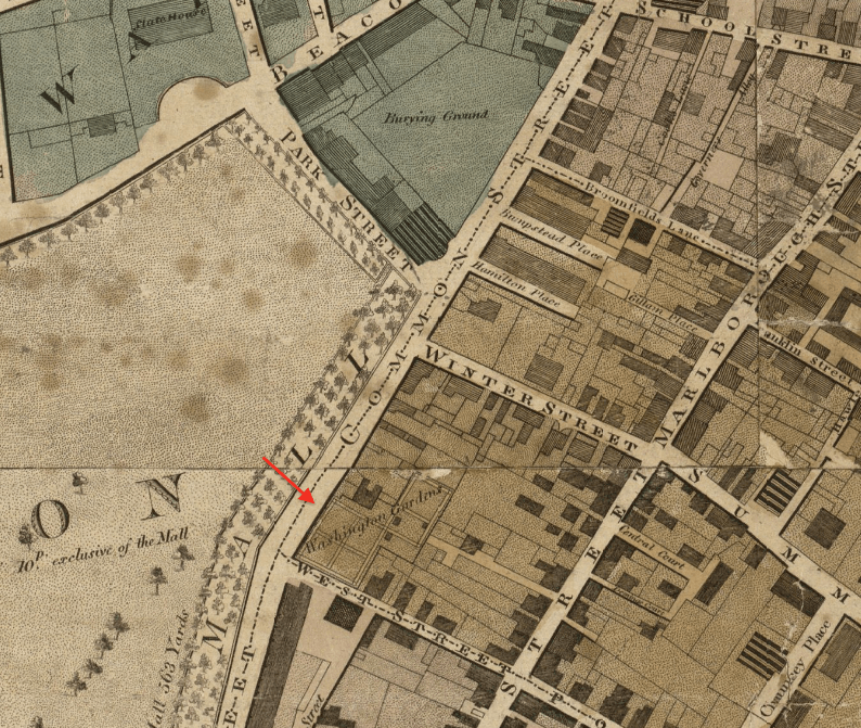
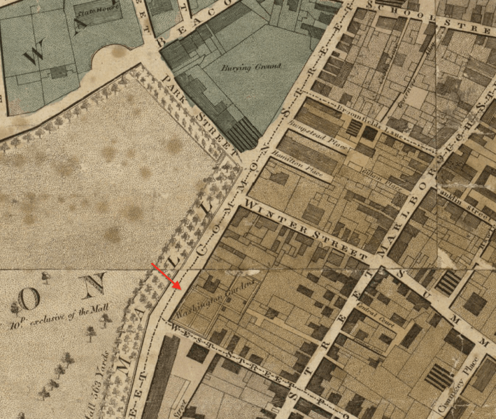
Image: 1814 TremontSt byHales map Boston detail BPL12926
Size of this preview: 709 × 599 pixels. Other resolutions: 284 × 240 pixels | 794 × 671 pixels.
Original image (794 × 671 pixels, file size: 497 KB, MIME type: image/png)
Description: Detail of John Groves Hales' 1814 map of Boston, showing Park Street, Common Street, and vicinity. Includes Washington Gardens
Title: 1814 TremontSt byHales map Boston detail BPL12926
Credit: http://maps.bpl.org/details_12926
Author: John Groves Hales
Usage Terms: Public domain
License: Public domain
Attribution Required?: No
Image usage
The following page links to this image:

All content from Kiddle encyclopedia articles (including the article images and facts) can be freely used under Attribution-ShareAlike license, unless stated otherwise.