
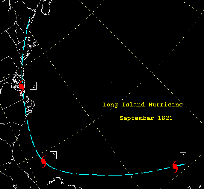
Image: 1821 Atlantic Hurricane Track Map
Size of this preview: 646 × 600 pixels. Other resolutions: 259 × 240 pixels | 681 × 632 pixels.
Original image (681 × 632 pixels, file size: 15 KB, MIME type: image/png)
Description: From http://www.wpc.ncep.noaa.gov/research/roth/sp1821.gif, this is a track map of the 1821 Norfolk and Long Island Hurricane.
Title: 1821 Atlantic Hurricane Track Map
Credit: Transferred from en.wikipedia to Commons. Transfer was stated to be made by User:bagster.
Author: The original uploader was Hurricanehink at English Wikipedia.
Usage Terms: Public domain
License: Public domain
Attribution Required?: No
Image usage
The following page links to this image:

All content from Kiddle encyclopedia articles (including the article images and facts) can be freely used under Attribution-ShareAlike license, unless stated otherwise.