
Image: 1826 CourtSt map Boston byStephenPFuller detail BPL10344

Size of this preview: 800 × 598 pixels. Other resolutions: 320 × 239 pixels | 805 × 602 pixels.
Original image (805 × 602 pixels, file size: 448 KB, MIME type: image/png)
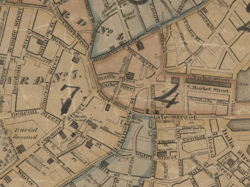
Description: Detail of 1826 map of Boston by Stephen P. Fuller, showing Court Street, Brattle Street, Market Street and vicinity. Title: Plan of Boston comprising a part of Charlestown and Cambridge. Author: Fuller, Stephen P. Publisher: Annin & Smith. Date: 1826.
Title: 1826 CourtSt map Boston byStephenPFuller detail BPL10344
Credit: http://maps.bpl.org/details_10344
Author: Fuller
Usage Terms: Public domain
License: Public domain
Attribution Required?: No
Image usage
The following page links to this image:

All content from Kiddle encyclopedia articles (including the article images and facts) can be freely used under Attribution-ShareAlike license, unless stated otherwise.