
Image: 1833 plat map of Grand Rapids
No higher resolution available.
1833_plat_map_of_Grand_Rapids.tif (568 × 577 pixels, file size: 440 KB, MIME type: image/tiff)
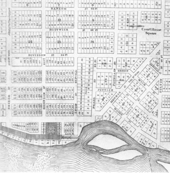
Description: A 1833 plat map of Grand Rapids, depicting the two villages created by Louis Campau and Lucius Lyon that abutted at Peal Street. Lyon followed the English grid system and Campau's plat followed Native American trails.
Title: 1833 plat map of Grand Rapids
Credit: http://www.mlive.com/news/grand-rapids/index.ssf/2012/12/feud_between_grand_rapids_foun.html
Author: Unknown authorUnknown author
Usage Terms: Public domain
License: Public domain
Attribution Required?: No
Image usage
The following page links to this image:

All content from Kiddle encyclopedia articles (including the article images and facts) can be freely used under Attribution-ShareAlike license, unless stated otherwise.