
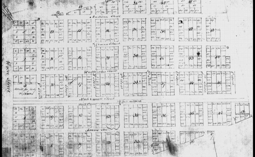
Image: 1837 plat map of Brooklyn, Illinois
Size of this preview: 800 × 493 pixels. Other resolutions: 320 × 197 pixels | 880 × 542 pixels.
Original image (880 × 542 pixels, file size: 114 KB, MIME type: image/jpeg)
Description: Plat map (cadastral survey) made for Thomas Osburn and four other white landowners who initially owned the land on which Brooklyn was built.
Title: 1837 plat map of Brooklyn, Illinois
Credit: Archaeologists Dig in Brooklyn, IL for Signs of Slave-Freeing Founder Priscilla Baltimore (in en). Riverfront Times. Retrieved on 22 August 2020.
Author: Unknown, but public-domain.
Usage Terms: Public domain
License: Public domain
Attribution Required?: No
Image usage
The following page links to this image:

All content from Kiddle encyclopedia articles (including the article images and facts) can be freely used under Attribution-ShareAlike license, unless stated otherwise.